Translate

07/25/14 Fox Peak 8796' #63

Climbing through the more-recent burn
On the 25th of July I headed south.  I was planning on meeting my friend and his family down near Hamilton for a bluegrass festival for the weekend.  For the day I was hoping to get up a couple of peaks near Skalkaho Pass.  As I turned onto the Skalkaho Pass Road I saw a sign that said it was closed 15 miles ahead.  I was worried that this would not be far enough to get me to the pass.  I drove down the road and was excited when there was no closure at 15 miles.  After another mile or two I thought I just might make it to the pass after all.  Just after I thought this I rounded a corner and saw the gate.  I had been shut down.

Since I didn't really have a backup plan I went off of what I had remembered about the maps and research I had done on the area before heading out there.  I had remembered reading on a website that the trail up Skalkaho Creek was only supposed to be four miles or so up to Trail 313, which is pretty high on and around the ridge.  I figured from there I could climb at least one, and probably two or three if I felt strong.

Jerry Lake and Fox Peak
The trailhead was closer to the road than the website implied and I started hiking up the trail which was an old roadbed.  After maybe 1.5 miles I had to cross Skalkaho Creek.  I took off my shoes and socks and hobbled across the rocky-bottomed but slow-moving creek.  From there I climbed into a burn and the trail flattened out as I walked a little above the creek.  The old burn provided excellent views and the drainage felt deep and unvisited.  I carried on and marveled at how wild the hills were and walked and walked.  Eventually I checked to see how long I had been walking.  It had been over an hour and I could tell I was not near the lake, Jerry Lake.

The trail had been traversing not far from the creek through the burn and had yet to do most of the climbing.  This is when I first realized the mileage I had seen online was quite wrong.  I was too committed at this point and carried on.  Eventually the trail crossed a couple small creeks and then turned up a smaller break in the hills and climbed following a creek.  The terrain was fun to travel through and the burn added some mystery to the undulations in the narrowing drainage and eventually I hiked out of the burn.  The climb had eased for a bit and I saw a crude bridge over the creek.  I crossed it and found what I could only figure was a spot hunters used often for a hunting camp.  It was in a great spot and it looked well used.

Fox Peak from the ridge
At this point I was starting to wonder how far Jerry Lake really was from where I took a brief break.  "I had to be close to the junction," I told myself.  I continued, climbing again, and into a newer burn (probably from the summer before).  The trail was shot with all the water that came out of the hillside because it no longer had roots to support.  The trail was wet and muddy for a few hundred feet or so and then it started getting rockier.  As I carried on climbing up the trail, admiring the flowers, I heard something crashing through the brush below me.  I never saw what it was, but I am pretty sure it was an elk.

Looking down on the route taken
I could tell from the terrain that I was nearing the lake.  The trail flattened out again and traversed on a large bench up toward Jerry Lake.  On the last traverse I was back in the green trees and brush.  There was a lot of elk sign and it even smelled of them in spots.  No wonder there was that camp lower down on the trail.  About 15 minutes after the trail stopped climbing so steeply I came to Jerry Lake.  It was a small, beautiful lake.  It didn't look very deep, but it's location made it a worthy destination.  I thought about how great of a camping spot Jerry Lake would make.  It would be an incredible base to climb Fox, Congdon, an unnamed peak, and Kent Peak.
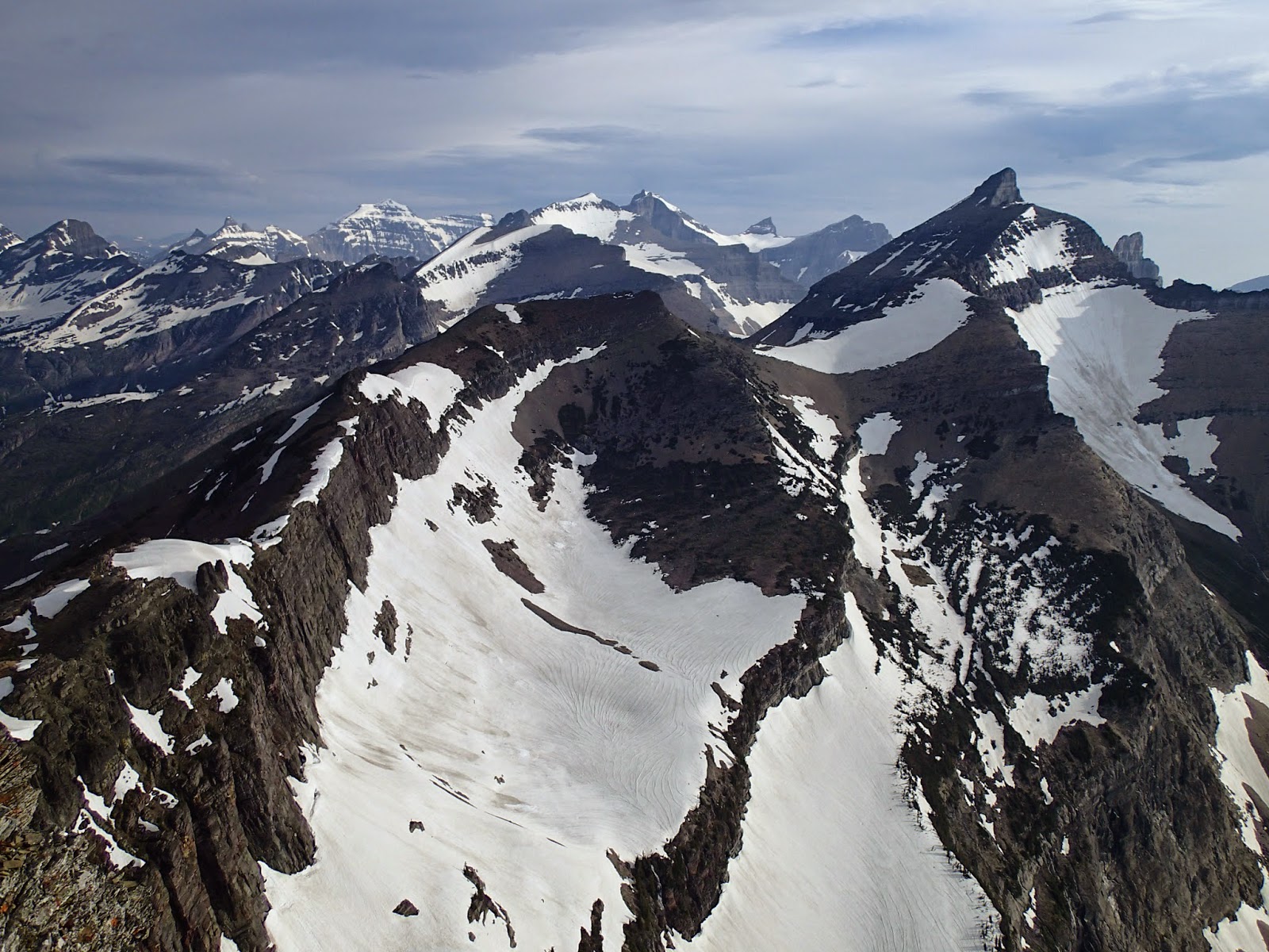
Congdon and Kent from Fox

I could see up to the summit of Fox and I set out with a time limit.  I was worried I would be too late to meet my friends if I didn't set limits, so at the lake I gave myself an hour to get to the top.  From there I had even set time limits to get back to the lake and car.  I hurried up the trail, which headed up the ridge for a bit.  After about 600 feet the trail left the ridge to traverse toward Congdon.  I left the trail and climbed right up the ridge.  The rock was fun in spots, but it was mostly tedious boulder hopping which took more mental and physical energy than I really wanted to be using.  I fought my fatigue for the rest of the way through the rocks until quite high on the ridge the angle mellowed out a bit and it was less rocky.  It was a pleasant last push to the summit.  I touched all of the highest rocks and sat down for a quick snack.  I sat looking toward the Anaconda-Pintler Wilderness.  These are some impressive-looking peaks and my list of peaks I want to climb grew.
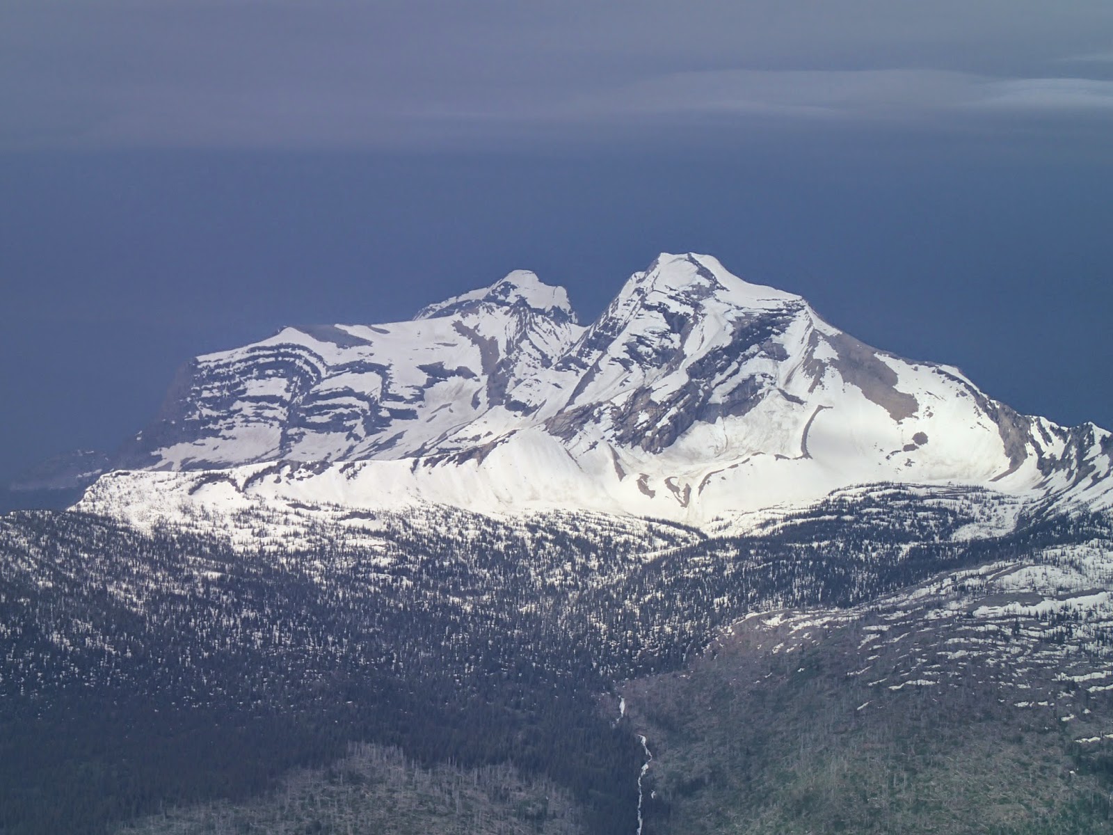
Closer view of Kent Peak, highest peak in the Sapphire Range

After eating and snapping some photos I headed back down to the trail and Jerry Lake.  I carried on down the trail and found it went faster than it had on the way up.  I rejoiced upon seeing the creek crossing.  Once across, however, I did not really want to put my socks and shoes back on my aching feet.  I did, knowing I was now only 1.5 miles from the car.  I walked the remaining distance back to the car, fighting the question in my head, "How much further?" all the way.  Fox Peak had been a great climb.  I had been completely fooled on the distance of the hike and I felt it.  For this reason I think Fox Peak was the hardest peak I had to work for up to this point. 
Looking to the Anaconda-Pintler Wilderness

Elevation gain:  3540'     Total gain:  109,280'

07/24/14 Unnamed 7723 and Unnamed 8620 #61 and #62

Heading into the burn
On the 24th of July I set out to do a quick climb of two peaks.  The round-trip distance was supposed to be 7.7 miles for Unnamed 8620 according to a Bitterroot Mountain climbing guide I have.  In that book, the peak is unofficially called Glen Lake Peak due to its proximity to Glen Lake.  As I turned onto the road to take me up to the trailhead I found a sign that said the road was closed ahead.  I didn't have a good backup plan so I carried on to see where the road was closed.  It was closed quite a ways from the trailhead, but I had my bike in the back of the car.  I sat in my car at the closure thinking about what I would do as it started to sprinkle and the clouds looked like there could be more rain in the future.  I decided to go for it.
Selway-Bitterroot Wilderness

I biked up the road and came to the "washout" that had the road closed.  I was surprised as it seemed to me that most vehicles could have made it past.  Instead of getting angry I took the optimistic stance that I would not see anyone else that day at what my book said was a popular hike to the lake.  I must have had to bike or push my bike (I'm not a big fan of riding a bike uphill) at least five miles.  Eventually I made it to the trailhead.

I was a bit worried about the weather even though the clouds seemed to be losing some intensity and retreating toward the crest.  It was quite breezy and I knew much of the trail passed through a burn.  This made me more nervous than the rain.  I set out up the trail and came to where the burn started.  I could see dark clouds headed my way and so I stopped a bit and found a tree to hunker under while I put on some rain gear.  The clouds never quite made it, dissipating as they made it further east.  I carried on out into the burn.  The wind was blowing and I kept my eyes and ears open for falling trees.  Thankfully nothing fell close to me.

Glen Lake
I made it up to a bit of a saddle and the Selway-Bitterroot Wilderness boundary.  Here I left the trail and headed up the rounded Unnamed 7723.  The downfall wasn't too difficult to negotiate and I made my way up to the top quickly.  The top was not all that evident and I walked around to all the point that looked highest.  It was beautiful with beargrass blooming everywhere.  As the summit was still in the burn and didn't have great, unobstructed views, I headed down to the west and met up with the trail on its way over to Glen Lake.

Beargrass between the lakes
I saw where the trail branched to the right and made note of it.  I planned on coming down that trail from above Glen Lake on my return if I could find it on the other side.  I continued on and shortly came to Glen Lake.  It is a beautiful little lake nestled into the mountainside.  From the lake, I made my way up toward the unnamed lakes above Glen.  The trail pretty much disappeared and I just kept hiking up through the burn, rocks, and beargrass.  I eventually came to one of the upper lakes and walked around it and began ascending Unnamed 8620.

First tricky boulder
 I started up the only way I found I could maybe make it and stopped short.  It required a bit of a move to get to the highest point.  I was pretty sure I could get up but not sure how easy it would be to get down (that often seems to be the problem).  I backed off.  I stood there and looked at the moves for a bit and then started again.  I was able to get a bit higher and then went for it.  I swung my leg up and got on the last sloped section of the rock and crawled the last two to three feet to where I could touch the top--there was some decent exposure pulling off to the east.  I turned around and moved back to the steep section of the boulder and edged off it.  It was going to be difficult to get my feet back in the right spots without turning in to the rock, but it wasn't too high off the ground.  I edged myself down, and with my body stretched out, jumped the last five feet or so to the ground.  This worked out just fine and I was smiling back on the ground.
Last tricky boulder

There was yet one boulder I had seen further east on the ridge that I didn't know if it was taller.  The map showed the highpoint being out on the western edge of the mountain, but this one boulder had me wondering.  As I made it back over that direction, I stopped and dropped my pack and started up it.  I came to a spot where it narrowed to a three-foot catwalk for about five feet to the highpoint.  The drop offs on either side were significant.  I hesitated and then went for it, again crawling across the scariest section until I could touch the top.  These are times I ask how important it is to actually touch the true top.  Apparently it is important enough to me to crawl across a catwalk to make sure I feel I have made it up the peak.
View back to the summit ridge from an upper lake

I made it off, gathered my things, and thankfully started hiking down.  I found a trail that took me all they way down to the upper two lakes.  From there, I found the other trail that bypassed Glen Lake and took it down to the main trail.  It was nice to loop the hike a bit.  Over the course of the day the clouds had retreated even further to the west and I had good views.  The wind also died down and the hike back through the burn was much less stressful.  I made it back to my bike and then had an enjoyable bike ride down to the car.  It had been two good peaks in the Selway-Bitterroot Wilderness.

Elevation gain:  3920     Total gain:  105,740'

07/20/14 Stahl Peak 7435' #60

Krag, Krinklehorn, and Deep
Lookout and beargrass on the summit
On the 20th of July I headed back up to Grave Creek near Eureka.  The climb from a few days earlier up Krag Peak helped to motivate me to get back.  This time I had my mind set on getting up Deep Mountain and Krinklehorn Peak.  I had visions of these two peaks playing in my day dreams and I wanted to climb them.  I made it up to where I thought the trail started.  There had been a sign for the trailhead down at the road junction, but there was no sign up where I thought the trail should be.  Fortunately I had looked at some old maps and could make a pretty good guess as to where I could find the trail.  As I followed old roads I did actually find a sign that had two little hiker figures on it.  I seemed to be on the right path.  Then I found a sign that said, "Trail," and had an arrow.

The view to the northwest
I followed this faint trail and after about 200 feet it more or less vanished.  There was blue flagging here and there and I followed it.  It led me in very illogical directions as to where I thought the peak should be.  I carried on, clearly not on a trail but determined to think I might find it.  At times I was just bushwhacking through the forest and didn't feel like I was anywhere near a trail.  Other times I would find some more blue flagging and followed it up an even older road bed.  Then I hit a high point and started descending with the flagging.  This didn't seem right but I let it play out and then it cut into the woods.  I followed it to another spot where it dropped again.

This is where I gave up and tried to find my way back along the non-trail I had followed.  It had taken me over an hour to not find the trail and I was frustrated.  The only consolation was that the wild strawberries were ripe and incredible.

Tuchuck and Canadian peaks just north of Glacier
I still had enough time to do a peak, so I drove over to the trailhead for Stahl Peak.  I had always wanted to get up this one since I did Wam a couple years back.  I had planned to meet Chris and Alysa down at Homestead Ales and didn't have a lot of time, but I figured I could get up and down in time.  I made it up the most direct trail to the summit of Stahl.  Down low it was a bit overgrown with alder.  It was so thick in spots that I began thinking about making a loop out of the trail and coming down the trail to Wam instead of retracing my ascent route.  It was a beautiful day; slightly overcast, but the wind and storm from the previous day had pushed all the smoke out of the area.

I worked up through switchbacks up the peak and eventually came to the summit.  The trail to get there was incredible once it climbed out of the brush and started cutting back and forth across the upper slopes of the peak.  The beargrass near the lookout was incredible.  I went into the lookout as it was open.  It was small but nice inside and I climbed to the upper level and enjoyed the views out the large windows.  It was a bit windy and I could feel the structure move a bit with each gust.  I snacked and decided I should head back.  I really wanted to make a loop out of the trail and decided I just might have time.

Beargrass and caterpillar
Saddle on the hike down looking toward Canada
I followed the trail down the other side of the mountain and toward the trail that heads up Wam.  I didn't really know how far or long it was so I moved at a quick pace.  It was pretty much a jog on the downhill portions and I grew quite tired heading to the junction.  It was beautiful and afforded me some new views.  Once I made it to the junction I figured I might have enough time to do the final 3-4 miles.  I was pleasantly surprised to find the sign said I only had a little over one mile back to the car.  I had forgotten how far it had been and overestimated the distance from the junction.  My tired legs and feet were most happy as I could slow my pace and enjoy the last stretch back down to the first trail and then on to the car.  It had been a great loop hike and I had gotten up another peak that had been on my list for some time.

Elevation gain:  2355'     Total gain:  101,820'

07/19/14 Matahpi Peak 9365' #59

Piegan through the smoke
Climbing toward the saddle
 I drove with my friends Chris and Alysa into Glacier National Park and we met Stuart at Logan Pass.  We drove down to Siyeh Bend to start the hike.  The original plan that Chris suggested was to climb Pollock and Bishops Cap.  Entering the park and driving along Lake McDonald we could tell it would be a hazy, smokey day.  As we climbed along the Going-To-The-Sun Road we could see the extent of the smoke.  Views were clouded by the haze and further peaks were just dark shapes.  It was windier as we climbed too and when we made it to the pass to pick up Stuart it was very windy.  We decided then to have an alternate as the routes up Pollock and Bishops Cap were ridge lines we'd rather not traverse in a stiff breeze.  We talked about going up Matahpi because it was straightforward and would be less troublesome in the wind.  Either climb could be done from the trailhead.

View of Matahpi from the saddle
At the trailhead we decided to climb Matahpi.  Not two minutes in we hit avalanche debris and hard packed snow lining the far side of the creek from where it had initially exploded off the shoulder of Piegan.  Other avalanches have ripped here in the past and it can be seen by all the trees broken and fallen or leaning in the uphill direction pointing away from the blasts of bigger Piegan slides.  Some are a couple hundred feet up the slope above the creek.

The well-maintained trail from there is quick walking and before long we were to the climber's trail that led up through the black cliffs to the saddle between Matahpi and Going-To-The-Sun Mountain.  From the beautiful meadow where the climber's trail leaves the main trail you can see the black cliffs.  They are not dangerous as there is a climber's trail that ascends and traverses from ledge to ledge until the top is reached.  It is actually quite fun through that section.  Much more so than the talus and scree slope that leads to the saddle.  Occasionally a band of larger talus could be followed, but in general, this is the most taxing section.

Chris climbing with Going-To-The-Sun in back
We stopped at the saddle so everyone could get on more layers.  The stiff breeze from earlier was now a ravenous gale.  The saddle has quite a drop straight down to the Sexton Glacier on the east side and the wind was pushing us toward the east, wanting to fling us off the mountain.  We pushed on toward the summit and saw another group of four coming down from the top.  We stopped and shouted to one another over the howl of the wind.  They were headed over to Going-To-The-Sun.  Near the top of the mountain there are many ledges and cracks that offer many options.  If we wanted we could take the easiest way, which was equivalent to a steep rocky trail, or we could take harder ways that allowed us to scramble a bit.  It was fun to "choose our own adventure" all the way to the top.

Top of Matahpi
Another beauty of the top, other than the fantastic, albeit smokey views, was that just off the summit to the east were great spots to sit and hang out without the wind.  Down just low enough, 15-20 feet, we were completely out of the wind.  The only problem was that it brought us a bit closer to the edge of an even more massive cliff that dropped straight to the Sexton Glacier.  We weren't right on the edge or anything, but we definitely always knew the cliff was there.  Alysa didn't feel comfortable dropping below the summit and stayed right on the ridge in the wind.
Flowers and rocks along the ridge line

After having a snack we decided to head down.  It was hard to tell what the weather was doing because of the smoke.  It was obviously overcast, but we found it difficult to determine if weather was moving in or if the clouds looked much darker because of the smoke.  We worked our way down the ridge and eventually came to one of the other group that decided not to climb the other peak.  She was huddled behind the only boulder of any size big enough to block the wind.  She looked a bit cold and we each said hello as we passed her.  From the saddle, we dropped back down to the trail through the black cliffs.  We stopped down below the cliffs and had a snack and enjoyed the views of a place we all loved.

Chris and Alysa heading down
From there it was short getting down to the main trail and then a quick walk down to the car.  The wind in the trees was much diminished and we enjoyed the hiking so much more as we dropped lower and lower.  Despite not climbing two peaks like originally planned and despite the smoke and wind, it had been a great day in Glacier National Park.


Elevation gain:  3515'  Total gain:  99,465'

07/17/14 Krag Peak 7510' #58

Krinklehorn through the haze
On the 17th of July I drove with my friends Kyle and Jordan and Kyle's dog, Karma, to the trailhead for Krag Peak.  We had actually set out to climb the neighboring peak, Krinklehorn Peak.  The day was hot and smoky and we started to climb gradually from the trailhead.  The trail starts on an old roadbed and is a good grade to warm up before climbing.  After the old road the trail climbs steeply at first and then breaks into a steady climb at a good grade.  We were ascending through a forest full of large trees and some undergrowth and it was cooler in the shade of the trees.  It was hot climbing, though, and we stopped when we reached a ridge and a breeze.  We had a snack and cooled off in the shade.

Kyle and Jordan climbing up the ridge
Not too long after hiking again we made the turn up the drainage that led to the saddle between Krinklehorn and Krag.  If we could, we were planning to climb Krinklehorn first and climb Krag as well if we felt well and had the energy.  The further we climbed up the drainage the more wild it felt.  We made it to a spot where we figured the trail had not been cleared that far yet as we came across more and bigger trees.  The obstacles in climbing over the trees was never too difficult or time-consuming and we made our way to the small creek flowing down the middle of the drainage and right under the massive, crumbly cliffs off a shoulder of Krinklehorn.  It was intimidating being below the cliffs and craning our necks up into the smoky sunlight to get a glimpse of our new world.

Krinklehorn Peak
The trail now followed up above the little creek that we could hear in spots.  Karma was driven mad at wanting to get down to the water she could hear but unwilling and, in spots, unable to make it through the downfall to get 50 feet below the trail.  The trail shortly left the creek and Karma's chance was lost.  Eventually we hit a switchback and climbed out on the southwest slope, where it was drier and the vegetation changed.  The walking was pretty easy on this section of the trail and we could catch glimpses of the saddle where the trail was to cross over and out of this drainage.  The saddle, along with the looming cliffs of Krinklehorn looked mysterious through the hazy smoke.

On the summit
We rested when we hit the saddle and I followed the trail briefly as it dropped off the other side.  It seemed to go down a ways and we decided we would just head for Krag.  To get to Krinklehorn we would have needed to drop down the other side a bit and follow the trail to where it crosses a gully/couloir and then climb that to get to the ridge, where it is straightforward from there.  That would have been more work.  Krag's ridge started right at the saddle.

The going was steep right from the start and then mellowed out a bit after the first 100 feet.  Picking our way up to a highpoint along the ridge and then following the ridge as it meandered up the mountain was quite enjoyable.  About half-way up the ridge flattened out some as it approached the final climb.  For much of the final climb we were able to climb open slopes right below the forested ridge to the east.  Before long we found ourselves on the summit.

Phlox near the summit
The views would have extended further if it hadn't been for all the smoke.  We could barely make out any of Glacier National Park.  Even much of the Whitefish Range was hazy.  the smoke seemed to be coming from the west and we could see very little in that direction.  We could pick out Wam and Stahl at first and by the time we were ready to leave we could hardly see them.  I could see some of the peaks I had climbed in previous summers in the Whitefish Range: Tuchuck and Thompson-Seton, Nasukoin, Lake, Link, Whitefish.  I just love getting different perspectives on mountains.  I was impressed by the view to Krinklehorn and Deep Mountain behind it.
Kyle on Krag Peak
Before heading down, I found a toad right near the summit cairn.  We were all surprised to see a toad up that high, especially with no water nearby.  We wished the toad well and went back down the ridge toward the trail.  On the way, an innocent-looking tree was bent over the path I wanted to take.  A rock below this small tree convinced me to step on it to help make my step over the tree easier.  As soon as I did it rolled out from under me and the tree hugged me (or I hugged it) as I fell to the ground.  I slowly stood up, laughing, and checked my new wounds on my leg.  The tree had cut me with five stabs and I was bleeding down my leg.  Jordan was kind enough to help me clean and bandage the worst two.
Along Krag's ridge

Patched up, we all headed back down the ridge, a little more carefully, to the trail.  We took some final gazes upon Krinklehorn to remember to return and then we headed down the trail.  Some clouds had moved in and helped block the sun as we descended the trail and the temperature was more bearable.  As we followed the trail down we realized it was quite a bit steeper than we had thought on the way up.  This, however, made for a quick descent and we found our way back to the car easily.


Elevation gain:  3470'     Total gain:  95,950'

07/16/14 Werner Peak 6980', Unnamed 7020, and Unnamed 7124 #55, #56, and #57

Werner Peak
On the 16th of July I left Whitefish in the late morning.  I wanted to get up a few peaks and had decided I would go toward Werner Peak and the two ranked summits standing further on the ridge.  Since it is possible to get up Werner without much effort as there is a road all the way to the lookout on the sub-summit with a gate on it no more than one mile from the top I decided to start at a further, lower trailhead southeast of the summit.

I started up a nice trail through a forest.  It climbed steadily to the top of the ridge that went northwest to the summit.  Once on top I was in an old burn and the trail was faint to non-existent with cairns marking the way.  This enjoyable ridge went on for about one mile before I dropped a bit and the trail turned into an old road that linked me up with the road to the lookout at the closure gate.

I didn't want to climb up the road as the true summit was on the ridge before the lookout.  The ridge also looked fun to climb and had a snow slope clinging to the east side.  At this point, it was a hot afternoon, sunny, and a bit smokey and I realized I may not have taken enough water to make it through the planned route.  I stopped at the snow and filled up one of my bottles wanting to extend my water as much as possible as well as to have something much colder to drink.  Then I carried on to the top of Werner Peak.  From there it was a nice walk over to where the lookout stood.

Unnamed 7020 and Unnamed 7124 in back
There was a woman out lying on a picnic table near the lookout and I asked if she was the lookout.  I learned then that she was not the lookout but that people can rent the lookout.  Her and her husband had driven past the gate and parked at the last snow drift blocking the road perhaps 100 meters from the structure.  I told her where I was heading and that I would see her later.  I headed down the trail from the lookout on my way toward Unnamed 7020.

On that northern ridge were some large snow drifts.  This gave me some comfort as I knew I could fill my bottle again with snow.  I carried on to the low point and then started up the trail as it climbed.  Near the top, the trail cut left to traverse below the summit.  I left the trail there and climbed the mellow ridge up to a rounded top.  There were many small, sub-alpine fir and it made it a bit difficult to determine the true top.  Close to the spot that seemed highest there was a good view north to Unnamed 7124.

I cut west and descended to the trail and followed it onto the north slope.  Here the terrain was steeper and the trail switchbacked many times.  There were larger and steeper snow drifts than on the north side of Werner.  Most helped to make the descent quicker and before long I was at the low point where the trail turned northeast into the China Basin.  Here I left the trail and started climbing the ridge.  Once through an initial thicker section with some downed trees I found myself on a steep, open slope.  It was steep enough to need to climb with small switchbacks.
Unnamed 7124 from Unnamed 7020

I made it through the steep section and found myself in flatter terrain and a small forest.  I worked through the trees and came to another snow slope, where I again filled my bottles with snow.  I continued on from there to the summit.  Unnamed 7124 is a peak with another high point further north.  It looks like it is probably lower when standing on the true summit, but I had to go out to it to feel confident I climbed to the true summit.  From the high point further north I could tell the first summit was the true high point.  I walked back over in that direction and took a short break.

It was a bit smokey, so the views were not great.  I couldn't even see into Glacier.  I knew I had a long way to go back, so I headed down the slope.  Near the low point I met up with the trail and climbed back up toward Unnamed 7020.  Fortunately I didn't need to climb all the way to the top and I traversed below it on the trail.  The same was true going over Werner.  Once I hit the road I took that down directly to the old road and up that to the trail.  The last bit along the ridge in the burn and the sun really made me feel dehydrated.  The end was pleasant through a shady forest and I reached the car quickly.

Elevation gain:  2520'     Total gain: 92,480'

07/15/14 Haystack Butte 7486' #54

Cloudy McDonald Valley guarded by Cannon and Heavens
I knew that the 15th of July would be my last day up at Granite Park.  I wanted to get another hike in before heading down and I thought about going north on the Highline to try to see some more bears.  In the end, I decided to head south on the Highline.  I figured that I had been north the day before and it was a rare opportunity to hike the southern Highline with no one on the trail.  It was still closed from Logan Pass to Haystack Butte.

Approaching Haystack Butte
I left the chalet and hiked south.  It was a bit overcast but the temperature was perfect for hiking.  As I had expected it was great to be hiking all alone on the southern Highline.  I enjoyed it thoroughly and stopped from time to time to look for wildlife.  I made my way through the alpine meadows and boulder fields as the trail wound into and out of small drainages.  I came around a corner and saw that a couple snow drifts had been shoveled by the trail crew.  I wondered if I would see any of them this day.  Shortly after, I found myself at the snowy Haystack saddle.  I had been watching the time as I needed to hike down and meet a ride.  I figured if I moved quickly I could get up and down Haystack Butte and leave enough time to get back to the chalet, pack, and hike down.

Start of cliffs and traverse slope on left
I left where the trail would have been under the snow and started climbing up the ridge toward Haystack.  Eventually I came to the main cliffs on the ridge.  I knew there were Class 3 routes through a bit to the southwest.  I had wanted to climb up these breaks as when I had climbed Haystack Butte in 2008 it had been mostly on snow through the steep section.  I traversed under the cliffs and looked for the route.  I found the two best options, but the beginning was covered by steep snow.  I didn't feel like climbing the steep snow to have to climb onto the rocks.  I knew I could keep traversing and eventually get to the south slope which was a walk-up.  That is what I chose to do.

Mount Gould
I carried on below the steep cliffs and slopes.  After a bit, I started angling up as the slopes above were less steep.  Eventually I could see all the way up.  It was a steep grassy slope and I knew I could get up it to the top.  I worked hard on that slope and was rewarded with better views as I climbed.  After maybe only 15-20 minutes of climbing I topped out pretty much at the large cairn.  I walked along the ridge back toward the northeast to get better views of Mount Gould.  The views were incredible all around and I was glad I could be atop another Glacier National Park summit.


Bishops Cap
Before heading down, I saw a couple trail crew workers far below on the trail.  I could recognize Mark from the summit but not the other.  I felt bad I didn't have the time to hike down and have lunch with them.  I needed to head back and worked back down the grassy slope and then below the cliffs to the ridge.  As I was mostly down the ridge I saw another worker just above the saddle.  I yelled out to him and hiked up to talk.  I could tell it was R.J. and climbed up the snow to the trail to say hello.  We caught up for about 15 minutes and he had to get back to work and I had to get back to the chalet.

The peaks near Logan Pass
I made it back and rushed to pack my bag and eat some lunch.  Then I found out the ride was delayed an hour and I relaxed a bit before hiking out of Granite Park, my home for the previous three weeks.  I hiked down the Loop Trail and carried on down to Packer's Roost, where I caught my ride.

Elevation gain:  2045'     Total gain:  89,960'

07/13/14 Unnamed 7980 and Swiftcurrent Mountain 8436' #53

View of Unnamed 7980 taken on July 7
I finished shoveling snow up at Granite Park on the 12th of July and decided to climb Unnamed 7980 in the morning.  The peak-climbing website I use to help track my climbs calls this peak The Garden Wall.  Since the Garden Wall is long and has higher points on it than this, I choose not to use the name and call it Unnamed 7980 instead.  This was a peak that I had been looking at often while I had been staying up at Granite.  I looked at it closely when I hiked up to the Grinnell Glacier Overlook on the 7th of July and had been using the scope to try to see a way up while I sat outside the chalet.  I felt I had a good idea of the best possible route and decided to see if it would go on the 13th.  I spoke with a guest that I had heard had tried the day before and he suggested I try the way I had been intending.  He had taken the ridge and became cliffed out and had to descend.
Upper portion of ascent gully

I left the chalet in the morning and quickly found myself at the Grinnell Glacier Overlook Trail and started up that.  I was surprised at how much snow had melted higher up on the slope and made my way across it quite easily.  I carried on to the overlook and found I was a bit intimidated by the view of the peak.  I followed goat trails from the overlook to where a gully cuts through the middle of the cliffs.  The view up the gully was not great as it was filled with loose rock.  It was, however, the only logical way up toward the ridge.

View of Mount Gould and Grinnell Glacier from the summit
The gully was steep and very loose and I slowly picked my way up it toward the ridge.  Near the ridge it became less steep and I found many ways to get out on the upper face.  Here I found the route finding to be very enjoyable with fun little passages between rocks and through cliff bands.  Before long I was standing on top.  There was another summit just to the south that looked to be about the same height.  I found my way over into a notch and then out onto the east face where I found passage up to the top.  From the top of that summit I could tell that the first summit was higher.  I walked back over to the highest point and enjoyed a snack along with some incredible views.

After the break, I worked my way back down to the gully and then carefully down that to the goat trail.  I decided that since I had never been to the second overlook, reached by following the goat trail, I would walk over to it.  I had descended a slightly different way instead of exiting the bottom of the gully and as I passed below it I saw a marmot licking the salt off a rock where I had placed a hand to pull myself up it.  I passed below this and carried on around the mountain below all the high cliffs and eventually found myself out in the second overlook.  The view of the glacier was great, as was the view down the whole valley.  A goat came into the saddle the same time as me but from the south and he crossed below me and headed out onto the east face of the mountain.  He stopped from time to time, seeming to take in the views.
View down the valley

After enjoying this new viewpoint I headed back along the goat trail to the maintained trail and down that back to the chalet.  I spoke with Morgan and he wanted to climb Swiftcurrent that afternoon.  I told him that after a nap I would join him.
Unnamed 7980 from the second overlook
In the afternoon, we left the chalet and started hiking up to Swiftcurrent Lookout.  Morgan had never been up it and I was excited to be going with him.  We made good time up to the junction and carried on toward the lookout.  Below us we spotted a couple bighorn rams and pointed them out to a couple hikers coming down the trail.  We continued on and quickly found ourselves up on top.  Buck was in the lookout and saw and recognized us and came out to sit on the steps with us.  He poured us some wine and we sat up top, taking in the views with a glass of wine.  It was beautiful and the weather was better than the 3rd and we stayed up top for some time.  Eventually we figured we should head back and get dinner.  We said goodbye and hiked back down to the chalet.
Iceberg and Wilbur from the lookout

Since I climbed Swiftcurrent Mountain on the 3rd I will only count that ascent toward my goal.

Elevation gain:  3145'     Total gain:  87,915'

07/03/14 Swiftcurrent Mountain 8436' #52

Swiftcurrent Lookout
I had climbed Swiftcurrent Mountain a couple times before but not during this year period for my project.  The last time I had been up to the top was with Carrie in 2009 and we made it up just before clouds enveloped the summit.
Continental Divide heading north
I had been working for over one week and was tired.  I decided to take the morning of the 3rd off and climb Swiftcurrent Mountain.  I was up early and left the chalet by 6:30 a.m.  I could tell by the tracks in the snow that there were two hikers in front of me.  That seemed to motivate me to hike faster and try to catch them so that I could be the first to the summit. 

When I was a bit below the pass in an open spot I could see them crossing the big snowfield higher up on the trail to the lookout.  I could tell it was a couple of older guys I had met the night before and knew I could catch them.  It wasn't that I was cocky, but I knew one of them was from Brazil and probably wasn't very used to hiking on snow and the other guy was just about to turn 72.  If I couldn't catch them then I needed to get in better shape.

I made it to the junction just below the pass and started up the trail to the lookout.  There was one snowfield to cross and then it looked like the rest of the trail was free of snow.  I crossed the snow quickly and made a couple switchbacks before I caught them at the next small snow drift.  We talked for a bit and then I carried on to the top.
Iceberg Peak
It was a beautiful morning and I was moving pretty fast.  I worked my way through the rocky switchbacks all the way to the lookout.  I checked the time and had made it in an hour and 15 minutes.  I felt good and took some photos of the surrounding peaks and then sat on the steps of the lookout to snack and enjoy the morning.  It was a bit windier than I had expected and the clouds were building.  I thought it would have been a bit nicer, but it still wasn't too bad.  I sat for about 45 minutes before Reggie and George made it up.  We sat together and talked about climbing peaks while shooing away the ground squirrels that seemed a bit too brave.
Vaught and Heavens and the oncoming storm

As we talked I noticed the clouds getting darker in the west.  At one point, I heard some thunder and decided I would head down.  They also chose to hike back to the chalet.  We were not in a good spot if the weather was to turn bad.  I said goodbye and started down, hustling to make it back to the chalet before any lightning struck or before it started to rain.  As I made it lower I felt better about the lightning, but the clouds were looking worse over Heavens and Longfellow.  I moved quickly and when I was back on the main trail I sped over the snow back to the chalet, getting rained on just a bit.  Fortunately the storm moved to the north and the rain was brief.  Not long after making it back to the chalet in 45 minutes the storm passed and it started getting sunny again.  It had been a quick yet enjoyable climb of Swiftcurrent Mountain.

Elevation gain:  1760'     Total gain:  84,770'