Translate

07/03/14 Swiftcurrent Mountain 8436' #52

Swiftcurrent Lookout
I had climbed Swiftcurrent Mountain a couple times before but not during this year period for my project.  The last time I had been up to the top was with Carrie in 2009 and we made it up just before clouds enveloped the summit.
Continental Divide heading north
I had been working for over one week and was tired.  I decided to take the morning of the 3rd off and climb Swiftcurrent Mountain.  I was up early and left the chalet by 6:30 a.m.  I could tell by the tracks in the snow that there were two hikers in front of me.  That seemed to motivate me to hike faster and try to catch them so that I could be the first to the summit. 

When I was a bit below the pass in an open spot I could see them crossing the big snowfield higher up on the trail to the lookout.  I could tell it was a couple of older guys I had met the night before and knew I could catch them.  It wasn't that I was cocky, but I knew one of them was from Brazil and probably wasn't very used to hiking on snow and the other guy was just about to turn 72.  If I couldn't catch them then I needed to get in better shape.

I made it to the junction just below the pass and started up the trail to the lookout.  There was one snowfield to cross and then it looked like the rest of the trail was free of snow.  I crossed the snow quickly and made a couple switchbacks before I caught them at the next small snow drift.  We talked for a bit and then I carried on to the top.
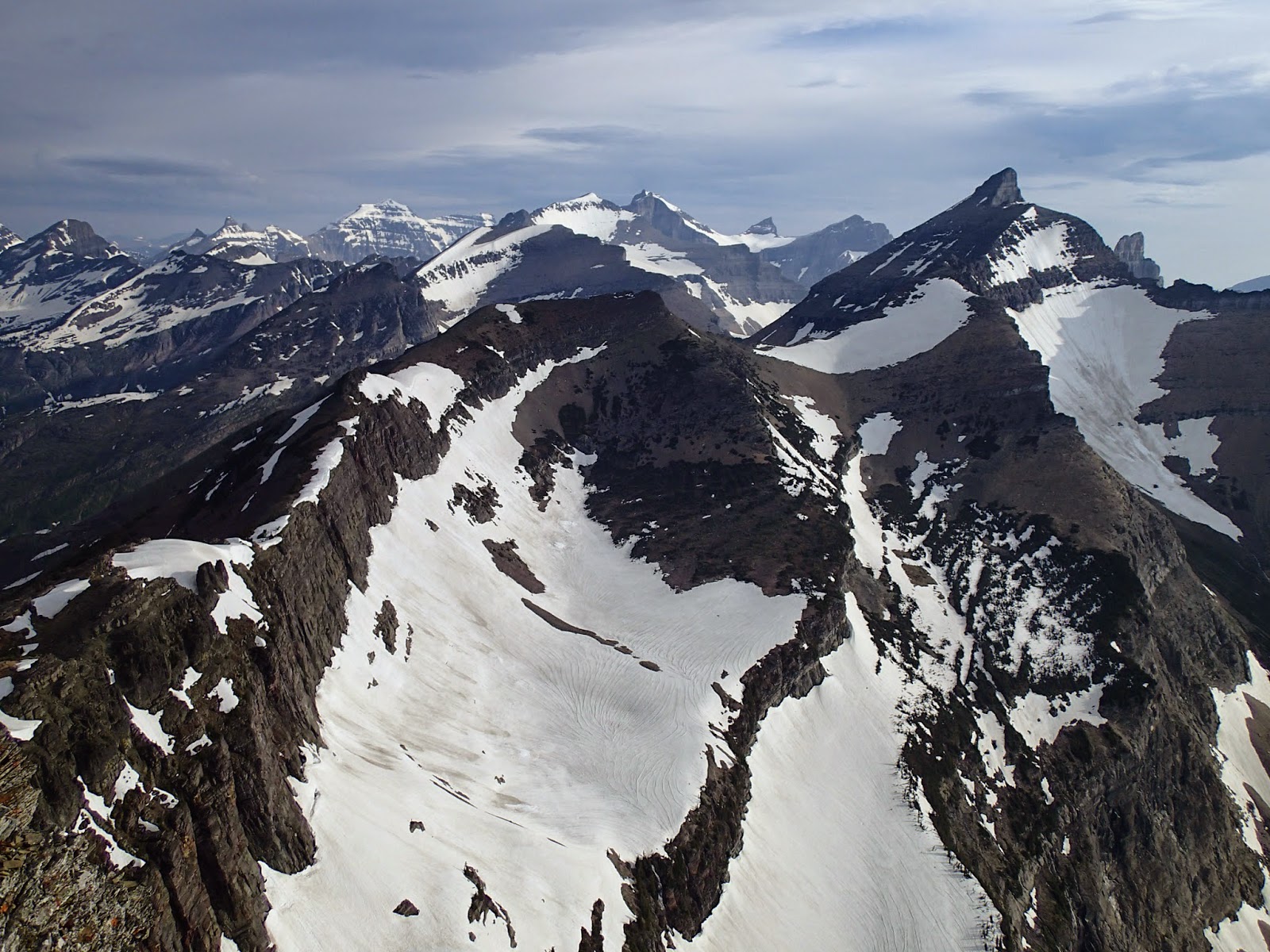
Iceberg Peak
It was a beautiful morning and I was moving pretty fast.  I worked my way through the rocky switchbacks all the way to the lookout.  I checked the time and had made it in an hour and 15 minutes.  I felt good and took some photos of the surrounding peaks and then sat on the steps of the lookout to snack and enjoy the morning.  It was a bit windier than I had expected and the clouds were building.  I thought it would have been a bit nicer, but it still wasn't too bad.  I sat for about 45 minutes before Reggie and George made it up.  We sat together and talked about climbing peaks while shooing away the ground squirrels that seemed a bit too brave.
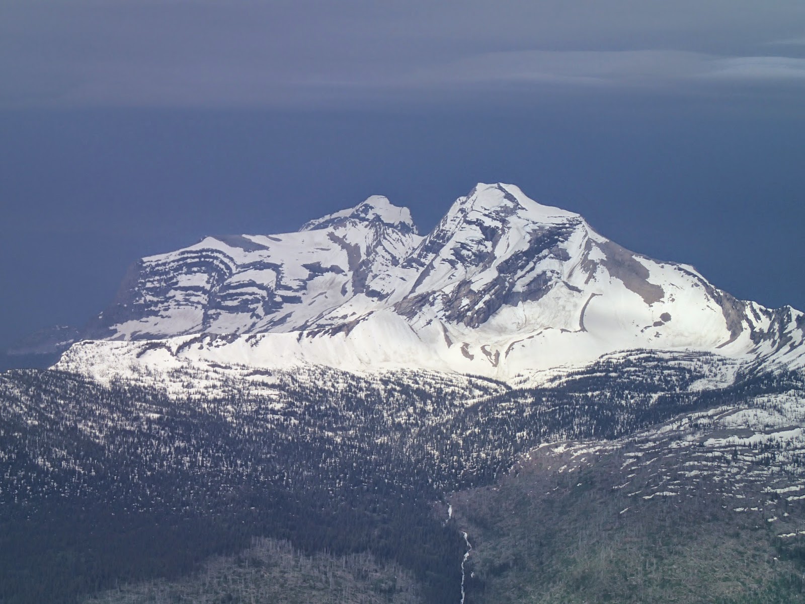
Vaught and Heavens and the oncoming storm

As we talked I noticed the clouds getting darker in the west.  At one point, I heard some thunder and decided I would head down.  They also chose to hike back to the chalet.  We were not in a good spot if the weather was to turn bad.  I said goodbye and started down, hustling to make it back to the chalet before any lightning struck or before it started to rain.  As I made it lower I felt better about the lightning, but the clouds were looking worse over Heavens and Longfellow.  I moved quickly and when I was back on the main trail I sped over the snow back to the chalet, getting rained on just a bit.  Fortunately the storm moved to the north and the rain was brief.  Not long after making it back to the chalet in 45 minutes the storm passed and it started getting sunny again.  It had been a quick yet enjoyable climb of Swiftcurrent Mountain.

Elevation gain:  1760'     Total gain:  84,770'

06/30/14 Unnamed 7720 #51

View of Unnamed 7720 from chalet on June 23
On June 23rd, I hiked up to Granite Park Chalet in Glacier National Park to shovel snow.  I shoveled for 20 days straight and enjoyed my time up there, staying until the 15th of July.  While there, I was able to climb four peaks toward my goal.  The elevation gain for this first peak will include the gain to get up to Granite Park.

On the 30th of June the Chalet opened for the public.  At this point I had worked for seven days and was ready to try to get up my first peak up there.  I had been looking at Unnamed 7720 every day--except the days it was rainy and cloudy--since I had hiked up to Granite Park.  I had climbed Swiftcurrent Mountain a couple times before but I had never gone up this peak on the other side of Swiftcurrent Pass.
Mount Grinnell, Mount Gould, and the Swiftcurrent Glacier

When I had been up at Granite earlier in the month and had hiked up to Swiftcurrent Pass I had seen a large snowfield leading up almost all the way to the cliffs that guard the summit.  So on this climb I decided I would go just past the pass and take the snowfield up to the cliffs.  I wasn't sure of the best way through the cliffs and hoped there was a way around them that I couldn't see from the chalet.  I could see that if no way presented itself that I could traverse below the cliffs back around the west side to some slopes that looked passable even though they were covered with thick, dense trees.
Mount Gould and the Garden Wall

On my way up to the pass I looked up and saw a break in the cliffs that was not as thick with trees and seemed to be an easy way up to the summit area.  I kept this in mind as I carried on to the pass.  The trail was snow-covered and the going was easy up to the pass.  I made it to the pass and the Continental Divide and carried on down the east side for just a bit.  I made it past the trees and found the snow slope I was looking for and started up it.  It was steep but easy to climb and I made my way to the top rather quickly. 
The chalet compound from the summit

From the top of the snow I traversed some rocky slopes a short distance to the base of the cliffs and followed them back toward the west and the break in the cliffs.  Once at the break I made my way up, picking my way through the rocks and around the small trees in spots until I was above the difficulties.  Then it was a short distance to the highest point.  I figured I was on top, but there were a couple spots that looked almost as high and that would yield better views to the south so I walked over to them.  There were goat trails along the ridge with goat hair caught in the branches of the gnarled trees that clung to the rocks.  I easily found myself on the other two high points and could see that the first was indeed the highest even though I found a benchmark further south.  Perhaps I was wrong on my estimation of the top.  I touched all the high spots just to make sure.
Swiftcurrent Valley from the ascent/descent snowfield

 From the southern high points the views to the Swiftcurrent Glacier and Mount Gould were incredible.  I could also look to the west and see down to the chalet compound and was quite pleased to be looking down on it.  I snapped some photos and enjoyed the views and scouted the snow on Swiftcurrent Mountain, which I planned to climb soon, before I decided to head back down.

I walked back to the first high point and then worked over to the break in the cliffs and picked my way through it.  Once down, I traversed back below the cliffs and over to the snowfield, where I enjoyed a long boot ski back down to the trail.  I followed my tracks through the snow back down to the chalet.

Elevation gain:  3425'     Total gain:  83,010'

06/22/14 Link Mountain 7227' #50

Avalanche debris on the road
On the 22nd of June I went out with Chris to try to climb my 50th peak--to get to the half-way point.  We decided to try to climb some snow up Whitefish Mountain up near Red Meadow Pass.  On the drive up the long, bumpy, dirt road an animal came out of the forest in front of the car.  It looked big and I thought it was a large dog or cat.  We noticed it had no tail and had very pointy ear tufts as well as the furry jowls.  It crossed the road and we sat there shocked that we had just seen a lynx.  We were glad we had decided to head up that road.
Heading up the ridge

As we neared the pass we were eventually blocked by snow on the road.  We parked and decided just to head up the road and see how far we could make it.  We figured Whitefish Mountain was probably out and that we might be able to get up Link Mountain.  The road was blocked by avalanche debris in a few spots and then was snow free until the turn for the trailhead.  Then there was a melt pond over the road and then snow up to the other melt pond that covered the trailhead.
Red Benchmark

We found the trail in spots and eventually lost it altogether and decided to just head up to the ridge.  We both thought that the trail was a bit more to our left as we climbed, but we never found it until we made it to the ridge and we found the junction with the Link Lake Trail.  From there we stayed on the snow and climbed up the ridge toward the summit.  I had climbed the peak a few years earlier while Chris fished down at Link Lake.  The ridge hadn't been too bad, but it was much better with snow.
I was a bit tired from a big week.  This was my eighth peak of the week and I moved slowly up the snow.  It was a beautiful day and the ridge was enjoyable and soon we found ourselves on the summit.

On top of #50
We took in the great views of many snowy peaks all around us.  There was an eagle feather up top and we placed it on the summit cairn.  I snapped photos of flowers and of the peaks I had climbed and the ones I now want to climb.  We enjoyed a snack and the partly-cloudy afternoon that kept the temperature bearable.

After some time up top we decided to head back down.  We made it down the ridge quickly in the snow and were back at the junction in no time.  We decided to follow the trail as our route up had been steep and not very enjoyable on some steep beargrass.  The trail was easy to follow and we were on it all the way back to the trailhead.  We bypassed the melt pond and were back on the road and quickly back to the car.  It had been a great day in the Whitefish Range.

Elevation gain:  2130'     Total gain:  79,585'

06/21/14 Unnamed 6134 and Unnamed 5865 #48 and #49

Nice trail and a nice day
On the 21st of June I went out into the Salish Mountains with Ben, Brian, Morgan, Chris, and Brian's dog, Clyde, and Chris' dogs, Althea and Barlow.  It was quite a group and probably the largest group I had been on for this project.  We drove into the Salish Mountains and found the unmarked trailhead.  Our main objective was to climb Elk Mountain and I had done some research and found that there were three other ranked summits along the way.  We set out to climb Elk and I figured if we had any extra energy we could climb any of the other three on the way back.
Approaching Unnamed 6134

The day was nice and sunny and it was nice to be hiking with many friends.  Despite the Salish Mountains being lower and less dramatic, we found the hike to be quite lovely and enjoyable.  The grass was green and there were many flowers blooming.  We climbed and descended through a couple saddles that could be turning off points for the other ranked peaks and I made note of the spots as we hiked through old burns and sporadic green trees.  After some time we decided to stop and take a nice break in the shade and grass where we had great views over to the Cabinet Wilderness and some of the snowy summits there.
Brian, Chris, and Morgan enjoying the summit

Shortly after the break we came to a junction with a sign.  We were shocked to see that Elk Mountain was still six miles away.  We had probably come four miles and we weren't sure any of us was ready for a 20-mile day, especially the dogs.  We found the trail we could take the next time we wanted to climb Elk.  We carried on, saying we would see how we felt, but I don't think anyone thought we would make it to Elk.  I told everyone that not too far away we could break off the trail and climb one of the ranked and unnamed summits and make that our new destination.
Althea enjoying the views

When we made it to the saddle we needed we left the trail and climbed easily to the top of Unnamed 6134.  It was open up top and we had great views to the Cabinets and to Glacier.  We could also see Elk Mountain and saw that it was still quite a ways from where we were.  This solidified our decision to turn back at this point.  We enjoyed our time up top and sat and ate and relaxed.

When we decided to leave we hiked back to the trail and followed it back toward the car.  At the junction we contemplated sending Chris with his dogs to the other trailhead to be picked up as Barlow is getting older and Althea was recovering from surgery over the winter.  After some talking about it he decided they would be fine and we carried on.
Heading back

At the last saddle Brian, Morgan, and I cut off the trail and headed toward Unnamed 5865.  Ben was so far ahead of us and Chris stayed with his dogs--he had to carry Barlow just a little bit at the end.  Brian, Morgan, and I made our way through the grass and boulders up to the summit of the unnamed peak.  It was neat going up it as we knew not too many people had ever gone up there.  It was rather small and we were up top quickly.  Not wanting to keep the others waiting we stayed a short time and headed off the summit on a different ridge that would take us back to the trail closer to the car.

After surprising a couple of deer we eventually found our way back to the trail and easily followed it back to the car.  We were all tired as the day turned out to be longer than we had anticipated.  It was a nice day to get up a couple of obscure peaks in an obscure Montana mountain range.

Elevation gain:  2630'     Total gain:  77,455'