 |
| Unnamed 4862 from Miller Creek |
There is not anything particularly exciting about Unnamed 4862. As my peakbagging addiction has gotten worse over the years, I have found more and more ways to lengthen my lists of peaks I would like to climb while never shortening them. One website in particular, Lists of John, has had a big influence in my lists growing, but it has also helped me to have some organization to my lists and given me goals within larger goals. One of these would be to hike all the ranked summits in a particular quadrangle map. For instance, Unnamed 4862 is just one of seven different ranked peaks in the Blue Mountain Quadrangle. At the time of this climb, I had already climbed five other peaks in the quad. By hiking Unnamed 4862 I would leave myself only one peak to climb to complete the quad. (Peaks I had climbed in this same quad already in this challenge include Unnamed 6004 and Black Mountain—#29 and #30—and Unnamed 5787—#32.)
 |
| Looking back to Blue Mountain |
 |
| Power lines on the route |
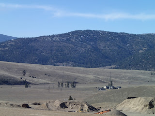
Finally, on the 28th of August, I made it out for a successful attempt on the summit. Like the last one, I started at the Motorcycle/ATV Trailhead and dropped into Hayes Creek. I climbed out the other side to the top of a small ridge and followed the trail down on what I thought was a short loop that would wrap back around to the ridge. The trail does do that, but I also found another trail that left from a point on that loop and carried on close to the bottom of Deadman Gulch. Near the bottom, but still a little above the small creek that sometimes flows there, a trail carried on down creek. Here I left the trail and crossed over the small creek bed and through some brush as I climbed up the other side. The forest was mostly open and the brush wasn't too thick working up to some power line towers. At this point, I linked up with a network of roads. From my map I could see that this road would take me close to the summit.
 |
| View of the summit from the road |
I followed that road, which was maintained but didn't seem to get much use, all the way to the saddle just before the summit. I left the trail and followed the gentle ridge up to the top. Like I wrote earlier, this peak is not particularly special, and I will likely never climb it again, but it provided a fun adventure and some splendid views into the Missoula Valley and the surrounding peaks that I was getting to know so well. I had an uneventful and enjoyable trip back to the trailhead.
Elevation gain: 2650' Total gain: 138,500'
No comments:
Post a Comment