Translate

08/18/14 Unnamed 6934 and Unnamed 6756 #74 and #75

Pearl Lake with Unnamed 6934 in the distance
On the 18th we had another leisurely start to our day.  We made some breakfast, warmed ourselves in the sun, and then broke down camp.  Pearl Lake had been a great spot to camp.  We shouldered our packs and started along the lake to the climb I had made on the 16th.  It was certainly more difficult with a heavier pack, but the views were once again well worth the effort.  At the first, lower saddle, we had great views from the trail junction down into Dalton Lake.  The next steep push to the ridge had everyone grumbling a little and wondering how much they had gotten into this last day, especially after the day we had all worked so hard for the day before.  (This is how I ultimately end up losing hiking partners, and I've gotten better about it than I used to be, but I was pushing my luck a little with this trip in an attempt to get five peaks in on the trip and get to #75.)  Once we reached the ridge we sat down, had some snacks, and took in the views, and the grumbling stopped.  The top of the ridge is a beautiful sight, and we could trace our route most of the way to near Hoodoo Pass.
Top of the ridge with Unnamed 7256 in background

The walk along the ridge was as great as it looked.  There were views for miles and we could see from one peak to the next, following many connecting ridges to the next and next, in Montana and in Idaho.  This trail straddles the state line, passing from one state to the other and back again.  From many locations, our best views were along the Montana/Idaho line, heading northwest, but there were plenty of viewpoints where we could look back down on Pearl Lake or Heart Lake and sometimes both of them together.  Those views of the two lakes with the ridgeline we had walked the day before rising beyond sure gave some perspective to our backpacking trip in this little corner of the state.

Ridge hiking

As we were rounding a hump on the ridge and descending slightly to a saddle from the Idaho side, we saw a goat ahead of us on the saddle.  It appeared to be alone, and as we approached further, the goat dropped off the ridge, down into Montana.  From where we were, it looked quite steep, but as we made it to the saddle we could see it was a short, mellow slope leading to the top of what was likely a steep snowfield—we could only see a patch and then the openness of a steep drop.  The goat was laying down on top of the snow, clearly trying to cool off as the day warmed on the open ridge.


Heart Lake and Pearl Lake (upper right) and Lightning Peak (left)
Eventually the trail led to within fifty feet of the top of Unnamed 6934.  Here we stopped and talked about how we would like to end the hike.  I informed everyone that I hated to be selfish, but that I really wanted to finish out the ridge because I could run off and bag one more peak.  There was another option to descend from just beyond the peak we were on back down to Heart Lake and then the car.  Jake and Rhian were fine with Carrie and I hiking out the ridge, but weren't sure how they felt about hiking the ridge and more so how Ava would do with a dry, hot ridge.  We rested in the shade of a nearby tree and had a snack while we discussed the two options.  It took a little convincing, but Jake and Rhian decided to come along on the ridge.  It helped that Ava seemed ready to go when we stood up to look at the trail to the lake.

Rock outcrops near second summit of Unnamed 6934
This is what gets me in trouble, though.  I know how much I'm going to love something like the proposed ridge walk and think that everyone else will love it as much as I will.  I tend to forget the pains associated with some of these endeavors and only remember the joys.  (Jake and Rhian and I are still great friends and we have hiked since, but I was certainly pushing it.)  To make matters worse, a map I had showed the summit on the other side of the trail that descends to Heart Lake at the same elevation, or very near, as the peak we were on.  Of course I couldn't trust that they weren't exactly the same height or even slightly higher, and which one is the true highpoint?  I had to go over to it.  As we neared the junction with the trail down to the lake, I explained my predicament and that I needed to run off trail to get to the top of that summit as well.  Jake and Rhian were fine with that but wanted to keep hiking on the ridge.
Along the ridge to Unnamed 6756

Carrie and I stashed our packs near the junction in some trees and made our way up to the summit.  It was a fun little climb with some interesting rock formations.  On top I could not tell which summit was higher but was pleased that I had been on both.  The views were fantastic down to the two lakes as well as along further toward Hoodoo Pass.  We could see Jake and Rhian along the ridge and gave them a hoot and a wave, and then we dropped back quickly to our packs and down the trail, eventually catching them.  In about half an hour we came to a spot where I asked if we could take a rest.  Everyone was glad to do so, and I again pushed my limits.  I explained that there was a final ranked summit I wished to climb not far off the trail and estimated that I could be back in about half an hour.  Jake and Rhian were fine with the break and Carrie felt the need to come along to not miss any peaks (I think).  We broke through some trees lower down and then a ridge became more obvious.  It wasn't as easy to follow as I had hoped with large rocks in spots and thick overgrown sections in others.  We eventually found faint signs of a trail near the top and some signs of a possible old lookout (small) or other structure.  No structure was remaining, but some of the wire cables which held part of it down were evident.  Along with the faint trail, we guessed there had been an old lookout up there.  We touched the top, took in the views, and turned to get back to our friends.  It took a little longer than expected, but not by too much.

Beargrass ghost forest
We continued down the trail and wrapped through another amazing slope filled with dried beargrass stalks.  Beyond that we started descending toward Hoodoo Pass and hit the junction leading down the forested ridge to a trailhead closer to the one where we had parked.  We followed this trail down, catching some views through the trees down to Hoodoo Lake and passing the trail that headed there.  It was an easy-enough trail to follow and we descended to the road, where I assumed the role of car retriever, as was only fitting.  I left my pack with the others, taking only the keys and some bear spray, and jogged most of the two miles or so down to the car at the trailhead for Heart Lake.  I went and picked everyone up, and we had a pleasant ride to Missoula.  I would love to spend more time exploring in this area, especially a little to the south of where we were to climb Crater Mountain and Straight Peak.  Some day.

Elevation gain: 1880'     Total gain: 135,850'

08/17/14 Unnamed 6900 (S), Lightning Peak 7380', and Quartz Benchmark 7770' #72 and #73

Well it has been some time since I've updated this blog, but it is something I've always wanted to complete.  I will update when I'm able to so as to track all 100 summits during this one-year challenge.

Jake, Rhian, and Ava coming off Unnamed 6900
Saddle below Lightning Peak
On the 17th we woke leisurely, had some breakfast, and made a pretty good start in the morning on our way toward the main summits of the trip.  We walked briefly up Pearl Lake in the same direction I had gone the evening before.  After a short distance we decided to leave the trail and just head straight up the slope on our way to the ridge.  Jake and Rhian's dog, Ava, was not very excited about leaving the trail, and it took some coaxing to get her to join us on our off-trail adventure.  The slope was steep with old stalks of beargrass turning to seed and other flowers near the end of their bloom.  We worked our way up through the beargrass and sparse forest to the top of the ridge, and once on top we could see that we were a short distance from a highpoint on the ridge.  It was worth the slight detour to the top of that summit.  Upon returning home and reviewing a map and a peakbagging website I realized this summit gets a "Soft" rank, which means it falls below the 300' mark to be considered its own ranked peak, but because the summit has 280 feet of prominence, it is considered too difficult to determine its prominence exactly in terms of that 300' mark as the contour lines are 40' at best and sometimes larger.  This means that some of these "Soft" ranked peaks could potentially be within that 300', but at 280' this summit probably doesn't make it on that degree of error.

Ridge up Lightning Peak
Either way, the summit provided great views of the ridge we would follow to Lightning and beyond to Quartz Benchmark.  The walking along the ridge was easy and mostly open.  Occasionally trees would be growing thicker on the first section of the ridge, but a trail could be found sometimes off the ridge in the forest and sometimes it followed the ridge directly.  As we neared the hump before Lightning, the forest became more dense and the going became more tedious.  As the goal was Lightning, which was to the north, we were drawn in that direction in an attempt to cut off the top of the rounded hump and save distance.  This didn't necessarily work out in our favor.  We found cluster after cluster of fir that seemed more impenetrable than the last.  It's at these points where I start to apologize to the others as the plan was mine to go way out to these summits.  On the way back the old trail was a bit easier to find and follow and did lead closer along near the ridge.  Don't be tempted to cut off too much of this rounded hump.

Ridge walk to the true summit of Quartz
Near the saddle between the hump and Lightning Peak there is a beautiful meadow.  The grass was green and tall, and we enjoyed a part of the walk where we could go in any direction we pleased, especially after bashing through the trees.  From the meadow at the saddle there is an open forest that leads upslope to the ridge of Lightning.  Out on the ridge it is pretty open and the flowers were blooming.  We had some wonderful views off toward Quartz, which seemed to be quite a ways away.  We pushed up the open slope and eventually made it to the summit of Lightning Peak.  We found some shade to rest in and to help Ava cool off, and we had a nice lunch with great views from the summit. 

View from near summit with Saint Patrick Peak on right
The summit of Quartz appeared to be still quite some distance from Lightning.  Jake and Rhian were wanting to get down to French Lake to do some fishing while Carrie and I hiked out to Quartz, so we all hiked down the north ridge on the trail and followed it into the amazing basin below Lightning's summit and beyond to the first small saddle.  Jake and Rhian left us at this saddle and started down toward the lake on what appeared to be a faint trail.  It turned out that it was likely an animal trail, and it disappeared into thick brush well above the lake.  This eventually turned them around as we were all a long way from camp at Pearl Lake.

Walking on the open ridge

Beyond the little saddle where we left Jake and Rhian, the trail suddenly became the most clear and obvious it had been all day.  This lasted for quite some time as we ascended but deteriorated, in small sections at first and then in larger and larger stretches, as we climbed higher and the forest thinned out.  Eventually we reached a highpoint and could see over top of the mountain.  It still looked further away than I had expected.  This is a long hike, and we weren't even to the turnaround summit yet.  The afternoon grew longer and yet the weather remained perfect with sun and a few lazy clouds.  There was no trail near the top of the highpoint we were on and beyond to the true summit, but the ridge walk was very enjoyable with great views to the north and west.


Carrie and I shared the summit with thousands of lady bugs and enjoyed the weather and the views along with having attained the highest point in Mineral County.  We contemplated how long the walk back to camp was going to be and wondered about Jake and Rhian's adventures down at the lake.  Eventually we reluctantly stood up and tried to crush as few lady bugs as we could as we left to retrace our steps back toward Lightning Peak.

Unnamed hump (right), Lightning (left), and Quartz (left center)
The walk back was pleasant but long.  We stopped up in the shade near a small snowbank up in the Lightning Peak basin before making the final push up to the peak.  We sat and enjoyed some water, made colder with some freshly-scooped snow in our bottles, while we took in the beauty of the upper basin.  Rocks were perfectly laid and lined with flowers and grass, which, with the snow, gave us a small alpine feeling.  We found that the later in the day it became, the harder it was for us to leave our resting places, and we could have stayed in that upper basin forever.  For a bit we had wondered if we would see Jake and Rhian on their way back from French Lake.  After a ten minute break with no sign of them, the day not getting any shorter, and camp not getting any closer, we figured they were well on their way to camp and followed after them.

Pinnacle on cliff face with view back to peaks
The climb up Lightning was a grunt but worth it again for the view.  It was a quick drop on the open ridge back down to the saddle, where I spotted the trail heading off closer to the ridge of the unnamed hump than where we had first come to the saddle.  We followed this faint trail and it avoided all the thick growth we had encountered on the way out and led us to the open forest on top of the ridge before tapering out.  It was pleasant hiking along this ridge, and we made a final short climb toward the first highpoint we had climbed that day.  Instead of ascending it again we found a way around the north side that gave us nice views of a small pinnacle on a cliff face.  Near the cliff face there was a trail we followed, but it too eventually faded away in the beargrass on the face above Pearl Lake.  At one point we spooked up a deer that we saw jump once or twice, but if it was not jumping, its body was out of view in the thickest beargrass stalks I had ever seen.  We bashed our way through this beargrass ghost forest down to the lake and Jake and Rhian and camp.  They cooked a great meal that night and we were all in bed earlier than we had been the night before.

Elevation gain:  4050'     Total gain:  133,970'


08/16/14 Unnamed 7256 #71

Hiking around Heart Lake
On the 16th, I drove west of Missoula with Carrie, Jake, and Rhian.  We started a backpacking trip from the Heart Lake Trailhead.  It was a very nice trail up through lush forest to Heart Lake.  Views were nice in spots heading up to Heart Lake, but they became better once we reached the lake.  We encountered some other backpackers who were heading out and offered us their spot.  We had planned on hiking further--past Heart Lake to camp at Pearl Lake.  We saw one or two other groups camping around the lake as we continued to hike.  As we began to climb away from Heart Lake, it began to rain a bit.  Fortunately it did not last long and we pushed on to Pearl Lake.  Heart Lake had been beautiful, and Pearl Lake was even more impressive.

Near the Pearl Lake camp

We found a spot to set up camp a little past the middle of the lake.  We set up our tents and found a way to get up a food hang and then we relaxed.  Jake wanted to go fishing and Carrie and Rhian decided to go pick huckleberries near the foot of the lake.  I had pushed for this trip to have a shot at climbing five peaks in the whole trip and I had figured I needed to climb the first peak on the first afternoon.  It was going to be one of the harder sells to get the rest of the group to climb this random, unnamed hump in the middle of nowhere and in the opposite direction we would need to hike on the last day, so I figured I could hike up it and be back down in time to help cook dinner.

Dalton Lake
I left camp and followed the trail along the lake and then as it climbed beyond the head of the lake.  The trail was a bit steep, but it had some switchbacks that made it more bearable.  At the first saddle I found the trail that headed down to Dalton Lake as well as great views to that amazing lake nestled in below an impressive, cliffy ridge.  From the saddle, I followed steep trail that climbed toward the crest of the ridge and the Montana/Idaho border.  Eventually it quit climbing so directly and did a nice ascending traverse toward the ridge.  Once on top, I took in the great views.  Looking northwest, it was exciting to see the route we had planned to hike out along that ridge.  Equally exciting were the views toward the summit of the peak.  From the lower saddle I had thought the true summit was at the end of the ridge over Dalton Lake, but from the ridge it was obvious that the true summit was a more-mellow walk, mostly along trail, to the top.

The ridge that the trail followed for our hike out
I left the trail to stay on the ridge and save some backtracking.  Before reaching the final saddle I picked up the trail and found it very pleasant to follow it to the top of the peak.  While it may have not been the most stunning peak from the direction I had climbed it, it did provide some stunning views.  Looking east toward Crater Mountain and beyond to the south worked to greatly increase the number of peaks on my list of ones I would like to climb.  I stood on an outcrop of rock over a small patch of snow and had quite the perch over the Trio Lakes.

Two of the three Trio Lakes and Crater Mountain
After snapping some photos and trying to memorize the new and beautiful scenery, I decided to head back so as not to be late to cook dinner.  The descent back to the first saddle was quick along the trail.  I again decided to leave the trail so as to stay on the ridge and save some time.  Once back on the trail I descended quickly back to Pearl Lake and camp.  I made it back in time to help Carrie cook some dinner, and we sat up into the dark and starry hours enjoying the evening and each others' company.


Evening on Pearl Lake
Backcountry dinner


Elevation gain:  2600'     Total gain: 129,920'

08/15/14 Petty Mountain 7270' #70

Albert Point from the trail
On the 15th I set out to climb my 70th peak of the challenge.  I wanted to make it special as 70 seemed like an important mark.  I had been thinking about Petty Mountain all summer as I had climbed at least four peaks in the same area and used some of the trails that I would need to use to climb Petty.  Most people climb Petty from Petty Creek, but I had spent so much time in the Albert Creek drainage already and had my mind set on using the trails that circle the rim of that drainage.  I was going to start from the Albert Creek Trailhead, but I decided I would actually save some mileage from starting at the unmarked trailhead on the road up above Albert Creek.  I made the long, bumpy ride up that road to the start of the trail and began my adventure.
View toward Petty Mountain from the ridge extending from Albert Point

View toward Petty from highpoint
The trail descends initially from the road to the junction with the trail that drops down to Albert Creek.  I could have carried on from there and just followed the trail up the ridge to the summit of Petty, but I had had it in my mind to do the big loop for this peak and it was fitting for #70.  At the junction, I turned and headed down toward Albert Creek, turning at the next junction, in almost one mile, to the right and descending further to the creek.  The total loss of elevation was about 1000 feet from the trailhead to the creek.  I didn't mind as the creek is a great spot with a nice little footbridge and because the ridge that extends from Albert Point toward Petty was incredible.  I had spent a little time on that trail earlier in the summer and was looking forward to walking the entire ridge.
Summit hitchrail

I crossed the creek and began my climb up to the ridge.  Once there, I enjoyed the walk through the cool forest and recalled the previous hike where I had been up there.  There were some spots with great huckleberries and I stopped to sample them.  The trail along the ridge is very nice with an open forest and decent views.  It also feels surprisingly remote.  I saw quite a bit of bear and lion sign in torn up and flipped logs and cat scat.  Both of these helped to increase the feelings of being in a place more remote than it actually was.

Clouds moving in
The day had started a bit overcast, which was fitting as the day I climbed Albert Point along with the two unnamed 5620s it was raining.  However, once I made it up to the ridge, the sun was out.  I thoroughly enjoyed my time walking on the trail along the ridge, gaining and losing elevation here and there as I slowly climbed toward the head of the drainage.  Eventually the trail came to what seemed like a four-wheeler road.  The junction was unmarked and I was glad I wasn't heading in the opposite direction as I may have missed the trail.  I was expecting it to be a trail junction and not as much of a road as it was.  It was still a very rough and very steep road and I climbed quickly to some highpoints along the ridge.  I stopped on one and had a quick snack and took some photos before heading for the summit.

Enveloped
The storms seemed to be building and there were dark clouds around and rumbling from thunder could be heard in the distance.  I dropped off a highpoint and onto a trail from the end of the four-wheeler road.  This took me past another trail junction, and I stayed on the ridge trail.  In less than 30 minutes from the highpoint where I had stopped I came to the summit of Petty Mountain.  It was a bit of a strange summit, as it was not very obvious where the highpoint was.  There were some concrete blocks, which had helped hold down a structure or tower that was no longer there and a hitch rail right on the top.  I had carried one beer up to celebrate and I sat on a concrete block and drank it as the storm clouds moved in.

View back toward Petty
The clouds and the rumbling came closer and closer and I knew I had to head out.  I quickly followed the trail along the high, open ridge until the ridge became more defined and started dropping.  I thought for sure I would be hit with some rain and lightning and thunder, but some clouds moved in over the ridge and enveloped the ridge and me along with it.  I was able to descend quickly and really was not rained on much until I was closer to the end of my loop and the last five-minute climb back up to my car.  My knees hurt a bit on the hike down and I was worried for what that might mean for the remainder of the peak challenge.  Despite that, it had been a great day, and I had climbed a peak via a route I had been wanting to do since May.  I highly recommend it!

Elevation gain: 3650'     Total gain:  127,320'

08/07-08/14 Cleveland Mountain 7337' and Welcome Benchmark 7723' #68 and #69

Suspension bridge at start of the trail
I set out on the morning of the 7th excited about a plan I had to ascend some of the peaks in the Welcome Creek Wilderness.  My plan was to hike up the trail up Welcome Creek and to climb Cleveland Mountain and then make it over to Welcome Benchmark and then find a place to camp for the night.  The next morning I would try to climb a couple more unnamed summits before hiking back to the car.  As you can tell from the title of this post, I only made it up the first two peaks.
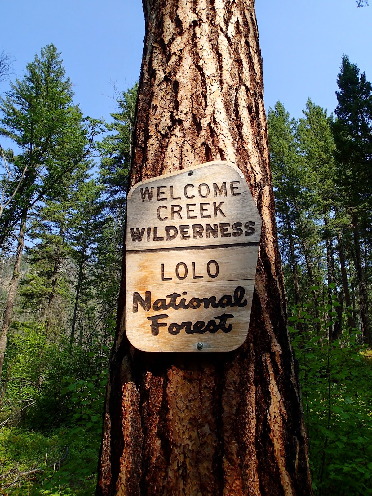
Wilderness boundary
I made it up to the trailhead along Rock Creek.  I really loved going back there and was excited to be to a new spot deeper down the drainage.  I packed the last bit of my bag and set out.  Right from the trailhead there is a long and high suspension bridge over the creek, which makes for an exciting start to a hike.  I carried on up the trail and was almost immediately in the wilderness.  The trail turned up the Welcome Creek drainage and I began exploring a new wilderness.  It was a warm day and the trail was pretty rocky.  The drainage reminded me of the other hike I had done off Rock Creek to head up Burnt and Babcock Mountains.  The drainage was steep and rocky, but at least it was not so tight that there was no creek.  Occasionally the trail walked by the creek and it made some lovely music as I continued up the drainage.
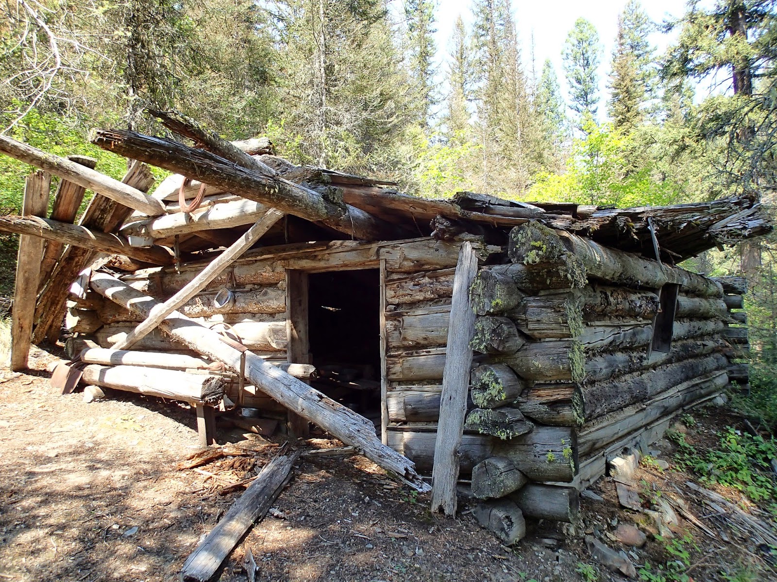
Old homestead along trail
Eventually I came to a creek crossing on a small bridge and then crossed the mostly-dry creek coming out of a side drainage.  At this point I carried on a bit further and found I had lost the trail.  I backtracked and made another attempt to find the trail and could not find the right way.  I did not want to be thwarted so early into the hike, so I backtracked a bit further.  Here, near the side-drainage creek, I found the trail climbed a bit and didn't stay near Welcome Creek.  It was hard to see because there were a few trees down at this point.  Glad to be back on the trail, I continued on up the rocky trail as it now traveled 100 feet or more above the creek.  It was beautiful.
On top of Cleveland
Not much further I came across an old homestead cabin.  I was ready for a break and sat to have lunch at the cabin.  The trail and cabin were quite a bit above the creek at this point.  After lunch, I hiked further up the drainage.  Beyond the cabin the drainage seemed to be a bit more lush, less rocky, and had bigger trees, which I appreciated for the shade they covered the trail with.  I had been under the impression that to climb Cleveland alone would be about a 15-mile day.  The further I made it up the trail, the more I started to question this.  It seemed to take a very long time to get to the point where the trail finally left the creek and really started climbing up toward the peak.
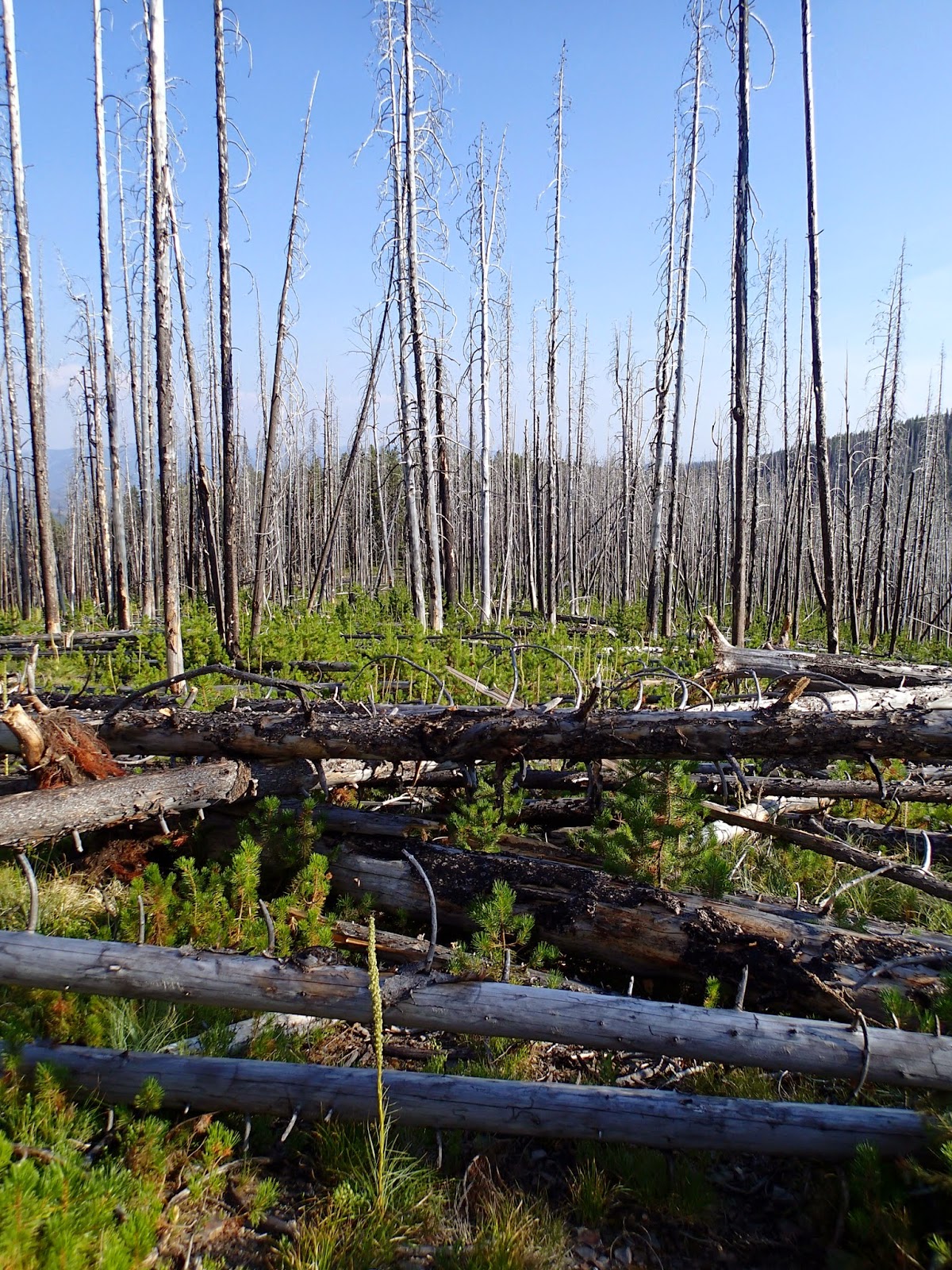
Tangle of trees on the trail
The first part of that climb was through a burn and was quite hot.  There were quite a few trees down across the trail too.  I pushed on and the second half of the climb was through a green forest, which was much cooler.  I kept going until I hit the junction with another trail.  Here I sat down briefly and had some water.  I didn't rest long as I knew I was near the summit.  I started hiking again and made it to the top within five minutes.  There were some trees up top and the views weren't great, but I was excited to be up there.  As I was quite tired and because I realized my initial plan of climbing 4-5 peaks was out of the question, I pulled out my sleeping pad, took off my shoes and found a place to lay down in the shade.  I rested for 20-30 minutes before putting my shoes back on, packing up, and heading back to the trail.

A little past the junction with the Welcome Creek Trail I came back into a burn.  At first it wasn't too bad as I descended to a saddle.  At that point, however, the downfall was thick.  I pushed on, going over and around the worst tangles and as more time passed I questioned what I was doing out there.  I could tell from the map that the trail traversed around a hill before climbing up that hill and heading toward Welcome Benchmark.  With how bad the downed trees were I decided to leave the trail and just set out toward the top of the hill to hopefully save some time and cut off some of my hiking through the worst of it.
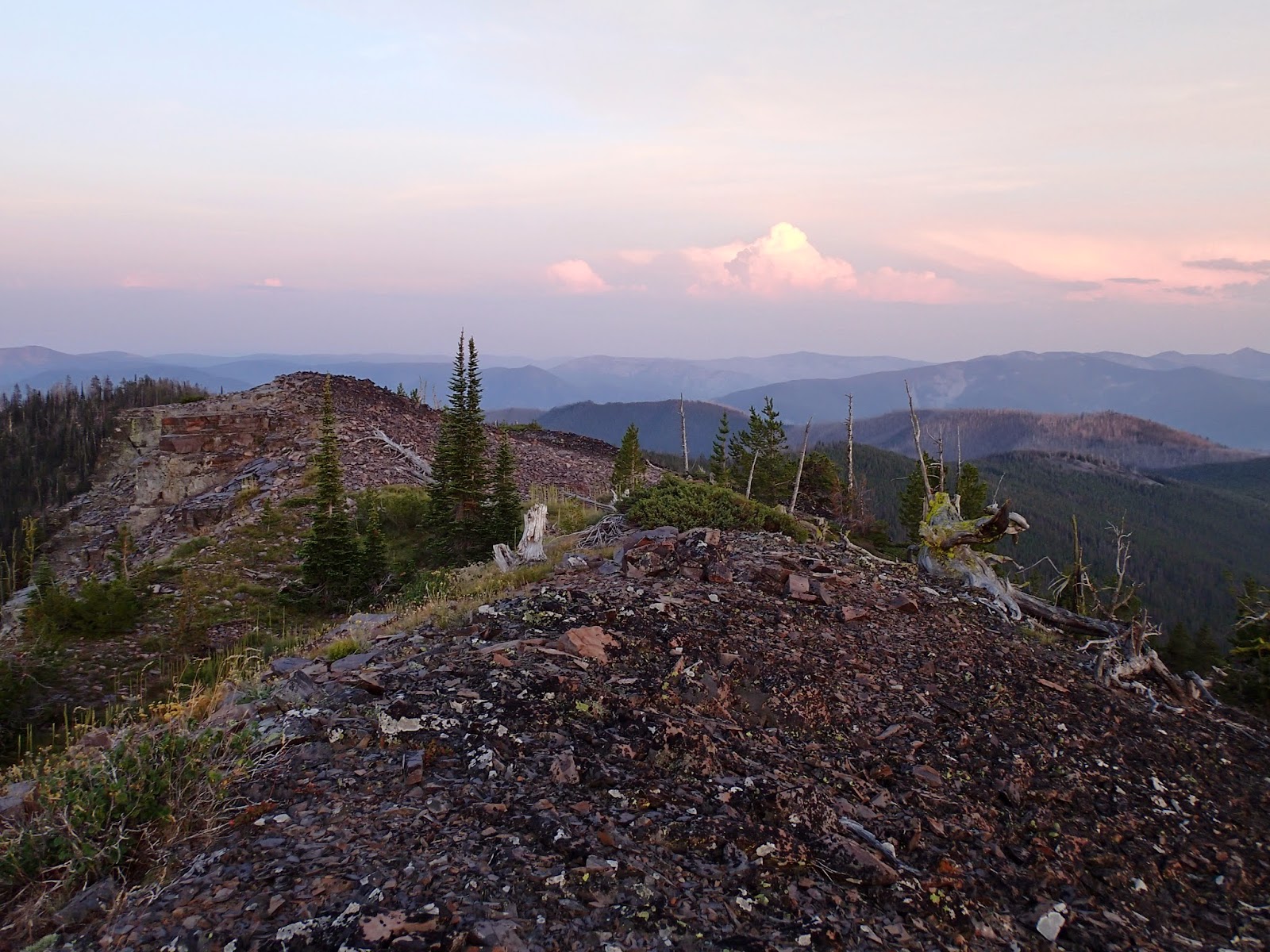
Two tops of Welcome Benchmark

It was perhaps slightly better off trail, or at least I told myself that.  As I was nearing the top of the hill and the trail again, I saw a little, spotted fawn in the mess of trees.  It was all alone and walking around.  I said hello and warned it to be careful as it was lucky I was not a mountain lion or bear.  Not long after seeing the fawn I hit the trail and turned toward the second peak.  It took me less than a minute to realize that this section of trail had been cleared.  I was ecstatic as that meant I would be able to hike at a normal pace.  I started up the trail as it climbed another slope.  At the top of that climb, I left the burn and found myself in a nice, open forest on a great trail.  This section from the burn to the peak was my favorite part of the trail.  It was pretty flat and in a great forest on a ridge.  I was enjoying myself and looked down the trail and saw a black bear thoroughly enjoying himself too walking toward me.  I pulled out my camera and took a blurry photo.  As I stood right on the trail I thought he saw me and continued walking toward me.  As he came closer I finally said, "hey bear," and it snapped him out of his daydreaming.  He seemed utterly shocked that he was not alone up there and he stopped and quickly spun and took off running the way I needed to go.
Smokey morning from the summit


I cautiously hiked up the trail and eventually decided the bear had turned off the ridge somewhere and probably was no longer between me and the summit.  I was excited to have seen a bear.  It was the only bear I saw on this peak challenge that was not in Glacier.  As I neared the summit I came across some cool rock outcrops.  There were still some blooming beargrass hiding in some of the rocks in spots.  Within 45 minutes of seeing the bear I came to the summit area.  Before going to the top, I found a spot where I would sleep and a spot to hang my food.  Then I took my dinner with me up to the summit.  There were two highpoints near on another and I couldn't really tell which was higher, so I went to both.  As I neared the second, I walked to the edge to look down one drainage.  Sitting there on a rock that I had not seen until approaching the edge was a golden eagle.  I was quite close and it took off as soon as it saw me.
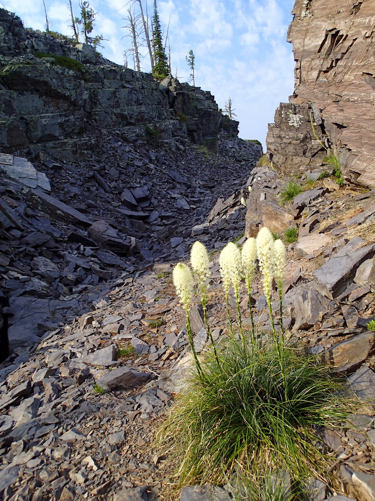
Beargrass

I sat up top and enjoyed the views and my dinner as the evening advanced.  Eventually there were a couple of white tail bucks walking around near the top and headed toward my things.  I walked that way to make sure they didn't take my backpack or sleeping bag and then stayed out watching it get darker from the summit.  Eventually I walked over to my sleeping bag and crawled in and fell asleep.

It was great getting to wake up in such a spot.  I immediately went back to the summit and watched a new day starting.  I had a small breakfast up top, packed up, and then headed back down the trail.  I again enjoyed the high forest on the ridge and decided to stay on the trail instead of taking the "shortcut" where I had seen the fawn in hopes that the trail was cleared at least down to the junction at the bottom of the hill.  It was cleared almost down to the junction and then the trail traversing that hill really wasn't that bad until I neared the saddle again.  It was slow going, but I was in high spirits and had more energy than I had the afternoon before.  I pushed through the downfall and made it back to the Welcome Creek Trail.  Along the upper reaches of that trail in the burn before making it down to the creek I stopped often to eat handfuls of huckleberries.
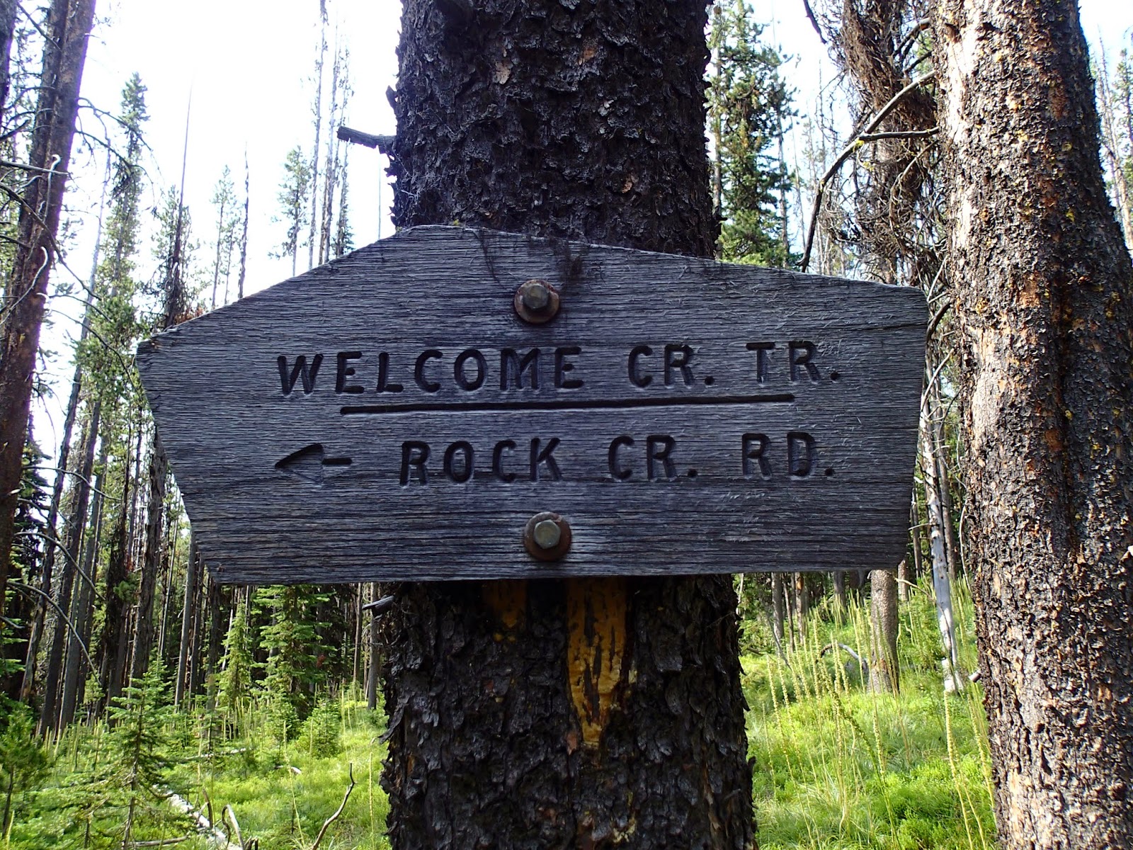
Trail junction
The hike out seemed to take less time, but it was still a long hike and I'm not sure Cleveland is a 15-mile round trip.  Either way, I had finally made it to the Welcome Creek Wilderness and climbed two peaks, one being the highest in the wilderness.  I would love to go back.

Elevation gain:  4940'     Total gain:  123,670'