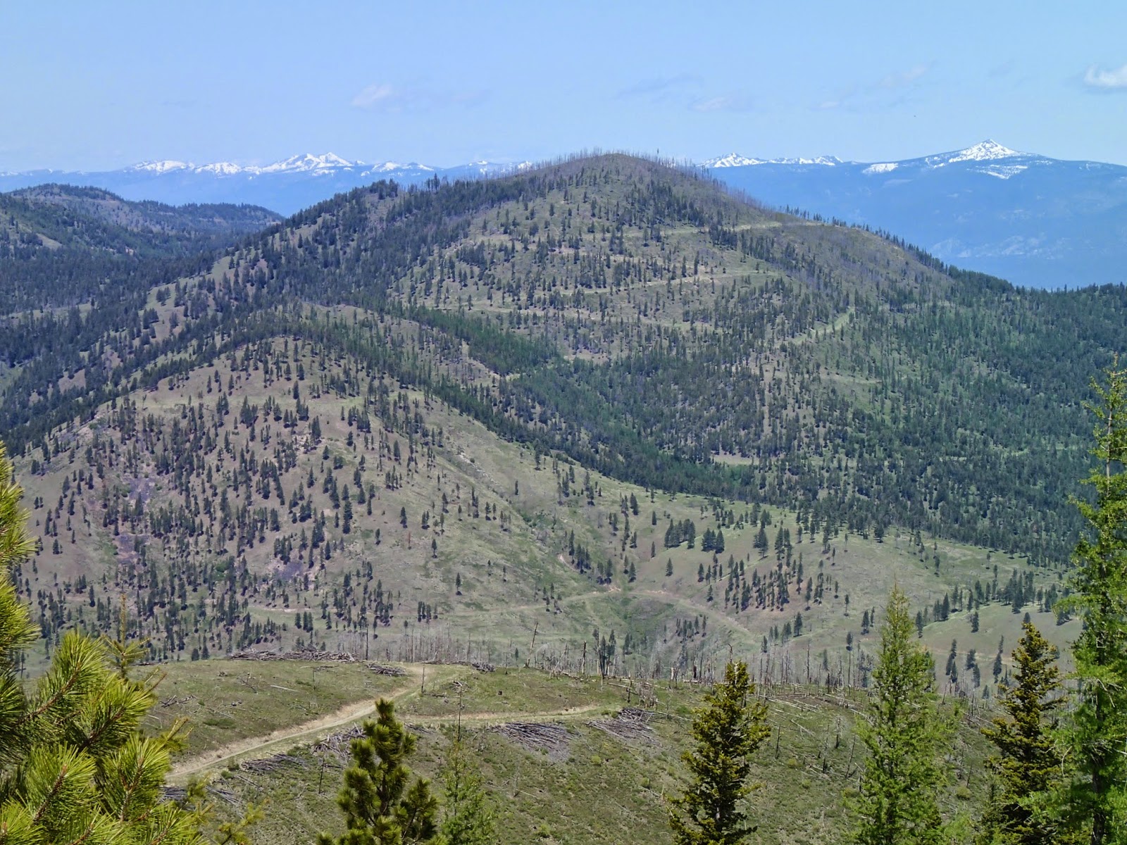
 |
| Black Mountain from the high point on the road |
Once back on the bike it was mostly a gradual descent for at least three miles to the saddle where I stashed the bike in the trees and began climbing up Unnamed 5787. From the saddle it was only a little over 300 feet to the summit. It started out easy enough and then I hit a section that had burned recently and most of the trees had been blown over perpendicular to the ridge and left a mess to negotiate. Fortunately it looked worse than it was from a distance and right up in it there were ways through that minimized the stepping over of downfall. I figured this would be the section where I would pick up ticks and, sure enough, found 2-3 when I was through the worst.
 |
| View of Unnamed 5787 from road to Unnamed 6340 |
Once past the downfall I came upon the faint scar of an old road and followed it a short ways up the ridge until it vanished. At that point the going was very easy and I traveled across open ground and through sparse trees to the quaint summit area. It was nothing spectacular except that it was a new summit for me and one that not many people had taken the effort to ascend. I find these are some of my favorites because of their obscurity. I quickly descened back to my bike as I had three more peaks I planned to climb that afternoon.
From the bike, I followed road 17779 easily as it climbed toward the next summit, Unnamed 6340. Part-way to the saddle there was a sign and the road was closed to motor vehicles. That was fine with me except that meant it hadn't been maintained for a long time and from the closure I could see thickets of alder and downfall across the "road." I stopped and thought about what to do. If I turned around here I would climb no other peaks that day. If I continued, it might be horrendous. I took my chances and continued, wanting to get up more than one peak with all the effort I had already expended.
It did, in fact, turn out to be horrendous. At first it was just thick alder with the occasional downed tree. I was no longer riding my bike. I was pushing it through thickets of young alder and as they grew too thick I moved to the side of the road and walked along the snow that bent the alder over into the rest of the road, carrying my bike. After awhile the thickets thinned and I was able to ride the bike again, glad I had pushed through.
 |
| The top of Unnamed 6340 |
I had a short coast down to a saddle and then the steepest section of road--I was no longer on roads for every vehicle. I had to push and did so for more than 300 vertical feet before I reached the summit of Unnamed 6340. The road went right next to the summit. It was not as obscure as the first summit, but most people that drove some sort of vehicle--motorbike or four-wheeler--over the top probably never realized they were near the top of a ranked summit. I did and stopped to eat my leftover breakfast for lunch. A pancake, peanut butter, and bacon sandwich never tasted so good!
From here I contemplated my future. I still wanted to make it to two more peaks. They were further on this 4X4 road. I was beat, way further from my car than I thought I would be, and the weather was turning for the worse. The breakfast sandwich gave me new-found hope and energy and I decided I would go on.
 |
| Contemplating my future from Unnamed 6340 |
I made it down the road a couple-hundred feet and ran into a big mess across the road. There was a jumble of trees down and I would have to leave the road and carry my bike around them. With that and how far the first of the two next peaks looked, I turned around and decided I had had a big enough day, especially when I finally made it back to the car. I pushed my bike back up the steep dirt road and stopped on the summit for a drink of water.
From there I made it carefully back to the saddle and then was able to follow road 17806 as it climbed and dropped, climbed and dropped eventually to Woodman Saddle. From here I had 2-3 miles of steady uphill to the high point on the road. I was beat and had to walk the bike a ways, despite the slight incline. I was glad I hadn't tried to get to two more peaks and then back over them to get to where I was. I was walking now and probably would have been crawling and crying my way up to the high point of the road.
Once I reached the high point I stopped to look back and remember the trials of the tough day. Then I saddled up and enjoyed the long and fast cruise back to the car.
Elevation gain: 3350' Total gain: 50,485'
No comments:
Post a Comment