Translate

06/20/14 Unnamed 6613 and Huckleberry Mountain 6593' #46 and #47

View up Unnamed 6613 from the ridge
On the 20th of June I went into Glacier National Park with Chris.  I had climbed Huckleberry Mountain a few times before, but I had never been on the unnamed summit on the ridge.  We brought our ice axes as I knew there would be some steep snow past the saddle and wasn't sure if we would want them.  Better to have them and not need them than to want them and not have them. 

We started out from the trailhead and found the mosquitoes were not as bad as expected--they can be pretty awful most years.  Chris had also been up Huckleberry, but he went up a different ridge and hadn't hiked the trail.  He was pleased at how nice of a trail it is.  It seems to be the perfect grade for climbing up or for walking down.  This great trail led us through the forest filled with huckleberry bushes and beargrass and before long we found ourselves on the last, open climb up to the saddle.
Last push to the lookout

The snow there was not as bad as I had seen it in previous years, but it was still quite steep.  Someone had gone before us and we could tell from his prints he was breaking trail with his 12-point crampons.  We didn't feel it was that bad--we both just had hiking shoes on--and we didn't even take our ice axes off our packs.
We began the traverse on the trail and when it neared a spot below the saddle on the ridge we left the trail and climbed up snow to the saddle.  Once past the little cornice and up top the going was easy.  We could walk along the open ridge or on the snow and quickly found our way up to the summit of Unnamed 6613.
Muddy North Fork Flathead River

We reached the top just before the man who had been breaking trail to the lookout.  He had been on his way back and had decided it would be easier to follow the ridge back than take the trail.  We talked to him briefly on how we had made it to the ridge and then he headed out.  He was loaded down with gear.  We knew he had crampons, and on his pack we saw an ice axe and snowshoes.  In his hands he had his trekking poles.  I wouldn't be surprised if there was a gps somewhere there too.

We enjoyed the views into the park and over to Huckleberry and then decided to head that way.  The going down to the saddle was quick and easy.  Mostly we stayed on snow and slid down almost right to where the trail came up to the ridge.  From there we easily followed the trail the last 5-10 minutes up to the lookout.
Huckleberry Lookout

We sat at the lookout and ate some lunch while we took in the great views all around.  The North Fork was brown and muddy and the view up the drainage was lovely.  The high peaks of the park were beautiful with all the late spring snow they had received earlier in the week.  We sat and enjoyed the break and the surroundings until clouds moved in and started raining on us a bit.  It actually cooled off quite a bit and we put on our rain jackets and headed back down the trail.
Chris heading down the trail with Unnamed 6613 in back

Fortunately the rain didn't last too long.  We had thought we would maybe retrace our track over the first summit, but then we figured that the trail really couldn't be that bad.  Staying on the trail would also save us extra elevation gain and loss.  It turned out that the trail was not very difficult and we quickly negotiated all the steep snow and found ourselves back at the saddle where the trail first climbed up high.  From there it was a pleasant walk back down the perfectly-graded trail to the vehicle.  It had been a great outing in the park and we climbed two peaks in the process.

Elevation gain:  3075'     Total gain:  74,825'

06/16/14 Unnamed 5620, Albert Point 5986', and Unnamed 5620 #43, #44, and #45

Albert Point from Unnamed 5620
You will notice that I have two peaks as Unnamed 5620.  I am not counting the same peak twice.  There just happened to be two peaks on either side of Albert Point at the same elevation.  I had been looking at this loop for some time.  The weather was not looking to be too good, but after having spent the weekend up at Granite Park in Glacier National Park in the rain and snow I was reminded that I can tolerate being wet.  I wanted to boost my numbers and this three-peak loop would be a great one to do, even in the rain.

I drove up the Albert Creek Road to the end and parked my car.  Then I rode my bike back down the road maybe two miles to where I would start hiking.  I took my bike across the creek and stashed it off the old road.  Then I started hiking up the old road.  The weather was actually perfect.  It wasn't raining yet and the clouds kept the temperature great for climbing.  I gained elevation as the road switchbacked up the mountainside.
Unnamed 5620 from below Albert Point

As I neared the beginning of the trail it sprinkled a bit.  I found the trail and started up it.  From there it wasn't too far before I was on top of the first Unnamed 5620.  The trail had been nice up to the top and the views over to Albert Point were good.  I could see the clouds were moving in a bit and I figured that before long it would rain.

I moved off the summit on the trail and started descending to the saddle.  The weather was still holding and I began climbing up Albert Point.  Somewhere about half-way between the saddle and Albert Point it started raining.  I walked through it a bit and then decided I would stop and wait a bit to see if it would pass.  I found a large Douglas fir and stood against the trunk as the rain blew in.  I started cooling off and realizing that the rain may stick around for a bit so I put on my rain gear and continued to wait.
Waiting out the rain

After some time and figuring the rain was settled in for a bit I decided to just hike in it.  I left the cover of the tree and started back up the trail.  The brush was wet and my feet started getting pretty wet.  I carried on, though, and as I neared the top the rain slowed down.  I didn't really have much for a view, but I wasn't getting dumped on any longer.  I hit the few spots that seemed like they could be the high point and then continued along the trail as it dropped off the other side of Albert Point.

Just past the next saddle I found the trail I would be taking back down to Albert Creek and eventually my car.  I was struggling with knowing if I should attempt to get up the third summit.  By that point, the rain had stopped and the clouds broke enough to let through a little sunshine from time to time.  That was all I needed to decide to go for it.

I carried on the trail that was headed toward Petty Mountain and climbed to another high point.  I knew from looking off Albert Point about where I needed to leave the trail to get out to the last summit.  I knew once I left the trail it would be the end of any semblance of dry in my shoes.  I was right.  All the brush was soaking from the earlier rain and as I moved through it the water left the leaves and blades of grass and soaked my rain pants, dripping down them to my shoes.  My feet were very wet in just a few steps.
Jumbled saddle

I followed the flat ridge out to where it started dropping to the last saddle with Unnamed 5620.  Here it became a bit steep and a bit thicker with the brush and trees.  I carefully made my way down the slope and found my way to the saddle.  At the saddle the trees were very thick and there was a lot of downfall that made the navigation slow and tedious.  Once around the downfall and headed up the other side it opened up a bit and I climbed to the last open summit.  I sat up top and ate some food and looked across at the first Unnamed 5620 and Albert Point.  It had been a fun journey and I knew that I now stood on the least-visited summit of the three.
Bridge over Albert Creek

After enjoying the summit for a bit I headed back down to the jumbled saddle and then up the other side.  Once across the ridge and back to the trail I knew my feet could begin to walk the water out of my shoes.  They never did dry completely, but they didn't get wetter either.  I followed the trail back down to the junction and then headed down that to Albert Creek.  It was beautiful down there with thick, green brush and large trees.  I was pleased to find a bridge to cross the creek and then I climbed up the other side to the junction with the trail I needed to get back down to my car.  This was the same trail I had taken on May 20th when I climbed Unnamed 5810.

I quickly made my way down this trail to the trailhead.  It had rained just a bit while I was on the trail from the last summit, but it had been on and off and light enough that I never put my rain gear back on.  I was happy to reach my car as I was tired and wet.  I just needed to retrieve my bike and the trip was complete.  It had been a great day.  I had climbed three peaks I had wanted to get up for some time.  Despite the rain, I had enjoyed myself.

Elevation gain:  4200'     Total gain:  71,750'

06/11/14 Babcock Mountain 6361' and Burnt Mountain 6385' #41 and #42

The sign at Mormon Springs was better than the trail
I had been wanting to get up the Rock Creek drainage for some time.  I had been looking at the Welcome Creek Wilderness, but one hike was longer to a single peak and the other hikes started with a ford of Rock Creek and the water was still a bit high.  I decided to try this hike, which I had seen part of it in a hiking guide.  This would allow me my first hike in the Rock Creek area and perhaps I could get views and an idea of the conditions in the Welcome Creek Wilderness.
Caterpillar gathering along Babcock Creek

I started at the Spring Creek Trailhead.  This trail walked me along some pasture that was private and then it climbed up a hill and traversed above the pastures to Babcock Creek.  Supposedly the cliffs and rocks above the trail were favorite hangouts for bighorn sheep in the spring but I never saw any.  The trail that traversed over to Babcock Creek was very rocky, covered by many ankle-turners.  I hiked along in the cool, morning shade and enjoyed looking at the flowers on the hillside.

Once across the hill the trail dropped into the Babcock Creek drainage and then turned up the creek.  I found out early on that rocky trails were the nature of this hike.  The drainage was tight and rock and talus fields came down both sides and the trail had to cross them.  They even covered up the creek and no water was seen for some time.  I had brought my gaiters in case of snow up high but I put them on down low because it was so brushy that my legs were getting scratched.  I was glad to have them even if I was using them for reasons other than what I thought. 
Mormon Springs

The drainage was tight the whole way up, but eventually a creek bed could be seen.  It was dry most of the time and the trail crossed from side to side as was necessary.  I saw quite a bit of bear sign--rub trees and scat--but none of it was very fresh.  It was nice hiking a spot that seemed to get more bear traffic than human traffic.

At one point, I heard something dropping through a tree.  I thought at first it might be a branch or pine cone and it landed within ten feet of me near the base of the tree.  It seemed odd and I looked up.  I saw a hawk flying toward the tree and when it saw me it changed course and flew away.  Now I was really curious.  I walked over to the base of the tree.  In the grass, I saw half of a squirrel.  It was missing a head and its upper body and was just the lower half and back legs and feet.  I had almost been hit by the hawk's half-squirrel lunch.  I snapped a quick photo and then hiked away so it could reclaim its meal.
A hawk's lunch

The further up the drainage I hiked the trail became fainter and fainter.  Sometimes the only thing reassuring me I was on the trail was the old cuts.  I may have been more worried if the drainage hadn't been so narrow.  There really wasn't anywhere else for me to go but to continue to follow it upstream.  There was a little water flowing from time to time as I hiked higher, but it was very minimal. 

Eventually I came to Mormon Springs.
I found the trail that headed up out of the drainage.  It was well-maintained at the junction and then again it turned into just a faint track that led across the hill.  It seemed like it had been cut out perhaps last fall and was easy enough to follow and after some time it led me to a dirt road.  There was a trail sign and I knew from my map that I was at the saddle between Babcock and Burnt.
Burnt Mountain from Babcock Mountain

I decided to head up Babcock first because it was lower and because, according to the map, the summit had two high points on the ridge at the same elevation.  Knowing how I am I knew I was going to have to walk the whole ridge to stand atop both summits.  I walked up the road a bit and then cut into the forest to follow a ridge.  The forest was nice and shady, open, and grassy.  I followed the ridge easily to a crossing of the same road and followed it a bit until it became faint and cut back across the hill.  I again followed the ridge up and before long I found myself on the summit ridge.
Arrow-leaved balsamroot

It was really not much of a ridge and was just grassy fields full of wildflowers with a few high points rising above the rest of it.  I walked from high point to high point until I was out at the furthest point.  It did not seem like it could be as high as the first point I had come to, but it was far enough away and I knew not to argue with a map.  I sat and ate some food as I took in great views toward the Welcome Creek Wilderness.  The view was made better as it was out over a field of balsamroot.  They were so thick that I could smell there incredible fragrance blowing in the breeze.
Old man's whiskers

After eating, I headed back to the first high point and then followed my route back down to the road and the saddle.  Then I followed the road toward Burnt Mountain.  It neared the mountain and turned to go both to the right and left.  I left the road here and went straight up the hill.  It was much steeper than the slope I took up Babcock and I was moving slowly.  I tried to stay in the shade of the trees despite a nice open, flower-filled slope nearby.  As the climb was just under 600 feet from the road I made it top shortly.  The views were even better from the top of Burnt as there were more open slopes falling away from the summit.  I sat up there for a bit and took everything in.  I snapped photos of the surrounding mountains and of the many flowers before heading back down to the road.
Rocky and brushy Babcock Creek drainage

From the road, I quickly made it back to the trail and followed it back down to Mormon Springs.  Once there, I knew the walk down would be pretty quick and easy.  It was except for how rocky it was near the bottom of the drainage.  By that point, my feet were quite sore and it was rather hot.  I was happy to make it back to the car and to sit down.  It had been a great introduction to some of the lower peaks of the Rock Creek drainage and I knew I would return.

Elevation gain:  3365'     Total gain:  67,550'

06/08/14 Pilot Knob 7262' #40

Beargrass in bloom
I went out on the 8th of June with my friends Jake and Rhian and their dog Ava.  We had set out to climb White Mountain.  It was a peak I found on a map and it looked like it had a trail to the top and a lookout on the summit.  We drove up past Lolo Hot Springs and turned onto the dirt roads and wound our way to the trailhead.  It wasn't a very official trailhead and had a sign pointing toward Pilot Knob and Trail 316, which we knew was where we had to start.
Spring beauty

We started up the trail and were amazed at all the beargrass that was blooming and getting ready to bloom.  We made it a bit up the trail and found that it hadn't been cleared of the downfall yet this year.  The further we went we realized it probably hadn't been cleared in a number of years.  It was an old road bed and in spots the downfall was thick.  We made it over and around the trees and continued to climb.  After some time we started wondering where the White Mountain Trail was and if we had passed it.  Not long after beginning that conversation we came to a spot where we had a bit more of a view.  What we could see was the ridge we needed to be on and at the end was the White Mountain Lookout.  We had missed the turn and we had missed it by quite a bit.

At that point we decided we would just keep going and we didn't care where we ended up.  It was a beautiful day and when the old road wasn't blocked by trees the walking was quite nice.  As we climbed higher the beargrass had not started to bloom, but the spring beauties were covering the forest floor.  In spots they were so thick that they almost looked like snow from a distance.  Eventually we did come to snow and decided to keep going.  We could still follow the old road easily enough and we had the energy.
Mariposa lily

As the snow became deeper I talked about trying to get to the ridge we were close to and perhaps climbing Pilot Knob.  Everyone was for it and we left the old road and cut back and up to the broad ridge.  We walked through the snow in the trees and never really knew if we were on the ridge, but the going was easy and we continued to climb.  After some time we came to a spot we felt was near the top.  We pushed on a bit and found a nice rock outcrop to sit on.  From the top of that we could see it was a bit higher to the south.
View to the Selway-Bitterroot Wilderness

Jake and I pushed on to see if we could find the true summit.  It took us maybe another 10-15 minutes and we were standing on the summit.  We found the metal benchmark and looked around.  There was another rock outcrop that looked higher.  We decided to head over to it and see how hard it was to get up it.  We had to drop a bit and then walked over to it and we walked around looking for a safe way to climb.  There was a way we could have gotten up, but the down climb would have been scary and possibly dangerous.  After looking at it and thinking about it for five minutes we decided it would be a smarter decision to not climb it.

As we walked away I was a bit frustrated to have spent so much time and energy to get near the top and not get up a summit.  I reassured myself that it had been a beautiful day and that it was great being out.  Yet always in my mind was the rock that looked higher.
Rock that looked higher

We followed our melting tracks back down to the old road and followed the snow back to where the road was dry.  On the way, we crossed some moose tracks we had seen on the way up.  Near them we saw fresh bear tracks that hadn't been there on our way up.  It's always fun to see bears, but it is also cool knowing it had crossed our path when we had been up high.  I wondered where it was going and what it might be looking for.

We made it back to the dry road and walked it back to the car.  On the way, near one of the thickest sections of downfall we found the White Mountain Lookout Trail.  It was hard to find and we had been focused on getting around the trees and we had missed it.  As there were many huckleberry plants we all said we would come back and hike that trail as well.

I struggled for a long time on whether or not to climb Pilot Knob.  We had, after all, seen the metal benchmark.  Would the 1934 crew that placed it not have climbed to the highest point?  I went back to the USGS Quadrangle map and looked closer.  The spot we had ascended with the benchmark was shown on the map to be a whole contour line higher than the rock we had walked over to.  This would have meant the map was wrong too if the other rock was indeed higher.  Could a map be that wrong?  A whole contour line wrong?  I thought back to how many peaks I had been on, even some recent ones, and how another summit looked higher until I went over to it and climbed it and looked back.  It has happened to me often.  It's very hard to determine a high point if there are other points near the same height.
Pilot Knob benchmark

I decided to count Pilot Knob based on a few things.  One was the difficulty in visually determining a high point.  The rock may have looked higher because it stood out alone.  The second was the fact that the benchmark was in the spot it was shown on the map.  The third was that the map showed the point with the benchmark being one contour line higher.  I could be wrong, but I'm putting my faith in the 1934 survey crew and the USGS map.  Perhaps I'll even try to climb one extra peak to make up for it all at the end.

Elevation gain:  2045'     Total gain:  64,185'

Peaks #1 through #39 complete

I have caught up on posting old peaks all the way back to #1.  Now I have from the beginning to #39 on the blog.  As of now, I have completed 62 peaks.  That means I need to catch up on posts from #40 through #62.  I will do my best to keep adding peaks.  I will no longer be counting backwards and will start the next one with #40 and try to catch up.  My feet may just be faster than my fingers.  Here are a few photos to give you a preview of what is yet to come.


11/17/13 Mount Jumbo 4768' #1

Jumbo from Sentinel 10/06/13
I don't think that on the 17th of November I knew I was starting this project.  If I had known I was doing this then, I probably would have climbed something the day before on my birthday instead of letting a day go to waste.  Either way, Mount Jumbo was the first toward my goal to climb 100 different peaks.  I had recently climbed it on the 31st of October and this was looking to be my last hike up in Montana before I went down to Colorado for most of the winter.
View of Jumbo Backbone 05/14/14

On this climb of Jumbo I went with Carrie, Kyle, and Caryn.  I imagine Diego the dog came with us, but I really can't remember.  My first time up I had gone with Kyle and we went up the "L" Trail.  This time we started at Jumbo Saddle and hiked the Jumbo Backbone Trail.  It was a nice trail.  In spots it was steep, but on the backbone it was quite pleasant.  The day was chilly and overcast and the views of the surrounding, taller peaks were not there for us to enjoy, but we still had a good time.  It was nice to get out walking and to get on a new trail.  It was also Carrie's first time up Jumbo, so that was exciting.  In all it was a great hike.
I forgot to bring my camera, so the photos are of Jumbo from other hikes.


Elevation gain:  1060'     Total gain:  1060'

11/27/13 Twin Sisters Peak 11,428' #2

Looking down the slide
I set out on the 27th of November with two main motivations.  The first was to drive up the Big Thompson Canyon to see some of the damage from the fall floods.  I had been in Montana and this would be the first chance I would have to see the damage.  The road had also just opened, so I was taking advantage of that.  The second motivation was to get into Rocky Mountain National Park and to get up high to see one of my favorite peaks, Longs Peak.  Twin Sisters has a classic, close-up view of Longs, and I wanted to see it close-up again.
The upper release; 20-30 feet deep and 75-100 feet wide
I had different information about the trail to Twin Sisters--the National Forest was telling me that the trail was closed, but Rocky Mountain National Park told me it was open.  I believed the park because I wanted to climb the peak.  I set off on the the trail through some snow.  It was not deep and was really just hiking with a bit of snow on the trail.

I continued up the mountain and as the trail was about to start a couple switchbacks I came to the major damage.  I walked right up to a spot where the trail was missing.  At the beginning it was just a washout that led into a 5-6 foot hole.  Then I looked beyond and realized the trail was missing for over 100 feet.  It was scoured and there were deeper gouges created by more water flow.  The trees were gone and it looked like a large landslide.  It went down for hundreds of feet and as I looked up I saw it had started a couple hundred feet above me.
Estes Cone and "Lightning Peak"

I crossed it and found the trail on the other side and followed the switchback right back into the slide.  At this point, I just headed straight up the hill as I realized the trail may be gone for some time.  Eventually I neared the top of the slide and followed the trail to where the top release happened.  At that point the trail went straight into a large hole.  It was 20-30 feet at the top and 75-100 feet wide.  It was very impressive, especially as there seemed to be no regular stream that was running through
there.  This gave me my first real idea of how incredible the flood had been.
True summit and Twin Sisters Mountain

I carried on the trail, which was not really damaged beyond other than some evidence of water running down the trail.  Eventually I made it to the uppermost boulder field and the last climb before the summit.  The rocks were a little snow-covered but the scrambling to the top of the true summit was not too difficult.  I sat up top for a bit and took in the great views of Longs and Meeker and the rest of Rocky Mountain National Park that I could see.  It was great to be back and see peaks I had climbed and loved for so long.
Another goal for the day was to head south climb up Twin Sisters Mountain, which was another ranked summit that I had not been up.  I decided that I would not head that way because the amount of snow cover on the rocks made travel difficult enough that it would take me some time to get to the next summit and back.  I was also feeling the elevation a bit as I was a little dehydrated and hadn't been up that high in some time.  Instead I decided to climb up the western summit for the more complete view of Longs and Meeker.
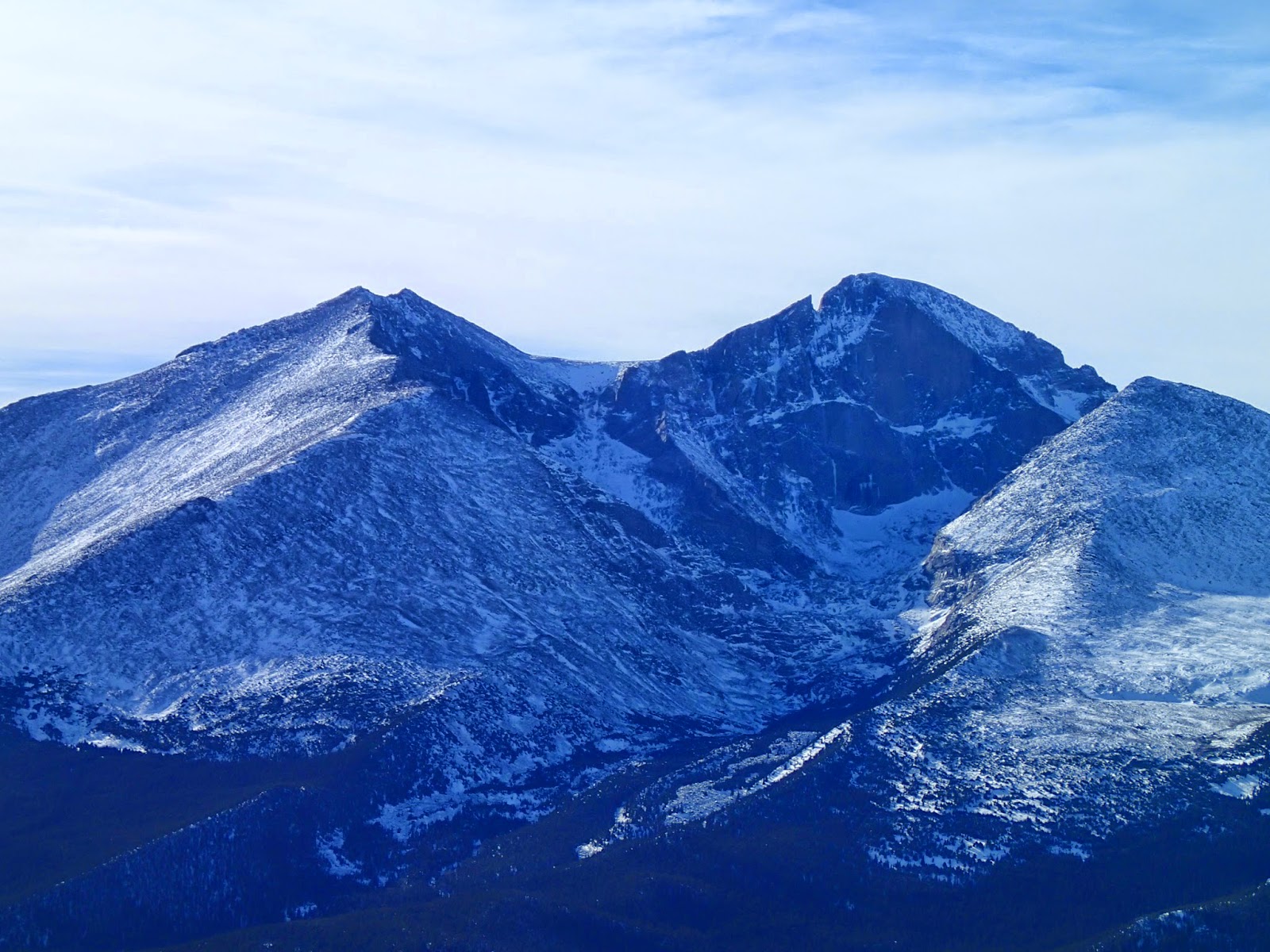
Classic view of Meeker and Longs

When I made it over that way I was surprised to find a trail up to the top of that summit and was surprised that in the three other times up there that I had never climbed up to the top of this western summit.  The views were great again and I spent some time up there taking it all in and snapping some photos. 

When I was satisfied and ready to descend I slowly made my way back down the trail.  I stopped again to examine the large landslide and to take more photos and then I carried on back to the car.


Elevation gain:  2480'     Total gain: 3540'

12/02/13 Eagle Cliff Mountain 8906' and Emerald Mountain 9237' #3 and #4

Eagle Cliff Mountain from the trail
I had been wanting to climb more peaks in Rocky Mountain National Park and Eagle Cliff and Emerald Mountains were the ones I picked for the 2nd of December.  Both are short and easy and as I don't feel great about minimizing my effort on small peaks I decided to climb them together from the same trailhead.  I also didn't have a pass to enter the park so the way I chose to do it maximized my effort for two easy peaks as well as allowed me into the park without having to pay.

View back toward Emerald Mountain on right
I started at the East Portal Trailhead and hiked over the hill to the Glacier Basin Campground.  I could have climbed Emerald first, but I chose to do it last as it was the higher of the two peaks.  The weather was windy and there was snow blowing off the Divide and it was drifted in spots along the trail.  It was never too deep and I found I never wished I had snowshoes.  I stayed on the trail on the edge of the campground and continued on into the YMCA complex.  I came out on a road and there was a bit of confusion, but I quickly located where the trail picked up on the other side and dropped to the crossing of Mill Creek.

"Thunder," "Lightning," and Estes Cone from Emerald
Once past the crossing I neared the Bear Lake Road and followed trail on the side of it, just in the trees, to the crossing of the Big Thompson River.  From there I left the trail and started up Eagle Cliff Mountain.  I left the main trail but soon found a climber's trail that led all the way to the top.  It was a pleasant surprise and made the ascent quite easy.  I was glad I had chosen this route and not tried to climb the peak from Moraine Park or the other side of the mountain.
The trail led me to the top rock outcrops and I found the tallest one and climbed to the top.  The views were limited to the west as snow was still blowing in from the Divide, but it was beautiful and clear out to the east.  I enjoyed looking at some of the peaks on the edge of the park, both inside and outside the boundary.  After some time up top I turned and followed the trail back down to the maintained trail.

From there, I followed my route back across the Big Thompson River and Mill Creek and back through the YMCA and by the Glacier Basin Campground.  I followed the trail back toward the trailhead to a high point and left it to climb Emerald.  Here too I found that there was a social trail that made the ascent quick and easy.

Emerald Mountain from near trailhead
On top, I had good views back to Eagle Cliff and to the east as well as of the storm still hanging on the Divide.  It had gotten a bit cloudier and colder and I decided to descend back to the trail and then back to my car.  It had been a good day with two easy peaks, made more full by hiking them from the same trailhead.  As a bit of a purist I felt better about climbing them this way than if I had climbed one and then driven to the next to climb it.  The day had been great and I was pleased to have spent it in Rocky Mountain National Park.


Elevation gain:  2945'     Total gain:  6485'

12/10/13 Unnamed 7309 #5

View of Unnamed 7309 on the way up
On the 10th of December I drove up the Poudre Canyon to climb a peak.  I had been looking at maps of the Greyrock Mountain area and saw there were a lot of ranked peaks nearby.  As it was not really early in the day I decided to go up Unnamed 7309 as it was near the Greyrock Trailhead.

I followed the trail toward Greyrock and at the point it cut into a drainage and then switchbacked out of it I left the trail.  I went up the drainage and climbed to the saddle between Unnamed 7309 and Point 7254.
View of Greyrock Mountain from the summit

As I neared the saddle and headed up toward the peak I entered a recent burn.  This was not too troublesome except that it was quite windy.  This kept me on edge and I watched the trees, ready for any to fall at any moment.  None fell on the way up or down.  When I made it to the top I took in the views of the surrounding peaks.  I thought about how I had been up Greyrock a few times and how it was the only peak I had ever climbed in the area.  My eyes had been opened to all the peaks in the vicinity and I thought about how and when I would climb up many of them.

After snapping some photos I decided to head down as the afternoon was getting late.  I descended back to the saddle and then the trail, carefully watching the dead trees as they swayed in the late fall wind.  Once back on the trail I made my way quickly back down to my car at the trailhead.

Elevation gain:  1750'     Total gain:  8235'

12/12/13 "Lightning Peak" 10,567' #6

View of Hallett Peak and the Continental Divide
On the 12th of December I went out with Zach.  We drove up the Big Thompson Canyon.  Despite it being my third time up the canyon, the devastation of the fall floods was still impressive.  We parked at Lily Lake and began our hike.  We were trying to follow trail a ways and then leave the trail and get to the saddle between Estes Cone and "Lightning Peak" and then come back to the saddle and climb Estes Cone and take the trail back to the car.  Over the course of the day our plans changed a bit.

We carried our snowshoes but ended up putting them on after a short distance.  The trail was easy enough to follow and snowshoes made it a
Zach on the summit with Estes Cone in background
bit easier on the trail.  After some time we decided we were at the point we wanted to be to leave the trail and start an ascending traverse toward the Estes Cone/"Lightning" saddle. 

The snow off the trail was not as nice as the snow on the trail.  It was just too much to climb through without the snowshoes, yet it was just not enough snow to make wearing snowshoes worthwhile.  We wore them anyway as it seemed it would be more difficult to climb without them.

After some time off the trail we realized we had probably left the trail a bit too low and early.  We had to climb more than we should have and had more of a shoulder to traverse around.  It wasn't that big of a deal, but we probably created a bit more work than if we had stayed on the trail longer.  It was a beautiful day and we didn't worry about it for too long.  We slowly worked our way through the forest and snow to the saddle between Estes Cone and "Lightning Peak."  From there it was a fun climb up to the summit.
Twin Sisters with the fall flood damage on left

The summit was rocky, as some of the ridge had been too.  Along with the sun and rocks, we had wind and we descended down a bit and used part of the summit block to block the wind.  We sat in the sun and enjoyed great views out to the interior of Rocky Mountain National Park and the Continental Divide.  From where we sat and rested the summit of Estes Cone looked to be a long way.  We decided there that we would leave that part of the trip for another day when the snow was deeper or gone or when we had more time and energy.  We would retrace our steps back to the trailhead.
Twin Sisters in the evening light

Doing so turned out to not be too hard.  We decided that for the way down we would not use our snowshoes, figuring it might be easier.  It was.  The distance seemed longer than we had remembered, but traveling downhill through the too much or too little snow (depending on how we looked at it) was quick and easy without the cumbersome snowshoes.  Before too long we were back on the trail and we followed our tracks back down to Lily Lake in the setting sunlight.  It had been a great day in Rocky Mountain National Park climbing an unofficially named summit that not too many people climb.

Elevation gain:  1610'     Total gain:  9845'

12/14/13 Rabbit Mountain 6006' #7

Summit ridge of Rabbit Mountain
I was heading to Carbondale to spend time with Dave and Alyssa and their family and wanted a quick hike before the drive.  I had recently discovered Rabbit Mountain Open Space and saw that they had a closure for wildlife that started on 12/15.  This meant the 14th was my last chance to climb Rabbit Mountain.  I drove through Longmont and to the trailhead.  This seemed to be a nice, small space with a few short trails that is very accessible.
Mount Meeker, Longs Peak, and Twin Sisters

I started out on the main trail and turned onto the Eagle Wind Trail.  This is a two-mile loop and I walked through the little bit of snow on the trail until it started to loop back around to the trailhead.  At this point, I left the trail and easily made my way up to the top of Rabbit Mountain.  The day was clear and sunny and I had great views out onto the plains as well as to the west and to the cloudy and windy Divide.  The view of Longs Peak and Twin Sisters was great.  I had read something neat about being able to see Boulder County's highest peak, Longs, from its lowest peak, Rabbit.  I thought about this as I looked to the high peak that had been standing so tall and visible from so many of my past hikes.

After snapping a few photos and enjoying the views I turned back downhill and headed back to the trail.  Once there, I took the side of the loop I had not hiked in and quickly found myself back at the car.  It had been a great morning hike to a summit.

Elevation gain:  500'     Total gain:  10,345'